The saw
Munxar is an old Maltese word for a saw. Recorded here by the sixteenth century, it probably reflects the headland's sharp, saw-like form.
A compact coastal hike along Malta's south-east edge, linking St Thomas Bay, Munxar Window, Munxar Point, St Peter's Pool and the Ħofriet.
Munxar to Ħofriet is less about distance than what the sea has done to the limestone.
Malta's south-east coast sits lower than the high western cliffs. Softer, paler rock has been cut into ledges, arches, platforms and rounded coves.
From St Thomas Bay, follow the coast past Munxar Window and Munxar Point to St Peter's Pool, then through Ħofra ż-Żgħira and Ras il-Fenek to Ħofra l-Kbira.
The appeal is the progression: an isolated arch becomes a pale cliff line, open sea gives way to sheltered inlets, and the trail ends at two coves scooped into the coast.
Saw-like headlands, rabbit points, natural pools and holes - the names echo the shape of the coast.
Munxar is an old Maltese word for a saw. Recorded here by the sixteenth century, it probably reflects the headland's sharp, saw-like form.
Ħofriet, the plural of ħofra - a hole or pit - names the two rounded coves: Il-Ħofra l-Kbira, the big cove, and Il-Ħofra ż-Żgħira, the small cove.
Ras il-Fenek literally means 'Rabbit Point' - the narrow headland separating the two Ħofriet.
Officially Peter's Pool, or Il-Bajja ta' Pietru, its rounded sheltered basin and flat limestone shelves explain the “Pool”. The origin of “Peter” is less certain.
The coast is easy to read, but the path is informal. Follow the landmarks and stay back from unstable edges.
The embedded Wikiloc track follows this same coastal line from St Thomas Bay through Munxar and St Peter's Pool to the Ħofriet.
A schematic sequence, not turn-by-turn navigation.
Navigation note: erosion is active here. Use a current offline map or GPX, avoid fresh breaks and stay well back from the cliff edge.
From St Thomas Bay, follow the shoreline to Il-Munxar. The window is the first major landmark as the coast becomes more exposed.
Continue around Munxar Point over low garigue, using the cliff line as your guide.
St Peter's Pool breaks the open shoreline before rounded bays lead into Ħofra ż-Żgħira.
Cross Ras il-Fenek between the Ħofriet and finish at Ħofra l-Kbira, where the coast feels more enclosed than at the start.
Retrace the coast, or keep the hike linear and arrange your return from Delimara.
Globigerina Limestone dominates this coast; its relative softness helps create the windows, platforms and rounded coves.
Upper and Middle Globigerina Limestone weather more readily than Malta's harder coralline cliffs, producing a lower, smoother coast.
Waves exploit fractures and softer beds, creating undercut cliffs, shore platforms, caves and arches like those around Munxar and the Ħofriet.
Research links the two rounded bays to marine erosion of the Globigerina sequence, aided by structural weaknesses and older drainage lines.
The route stays low, but shade is scarce and some sections pass actively eroding cliff edges.
Plan your return.
The edge matters more than the gradient.
Cool, clear and calm is best.
Simple kit, but little shade.
From open Munxar to the enclosed Ħofriet, the coast keeps changing character.


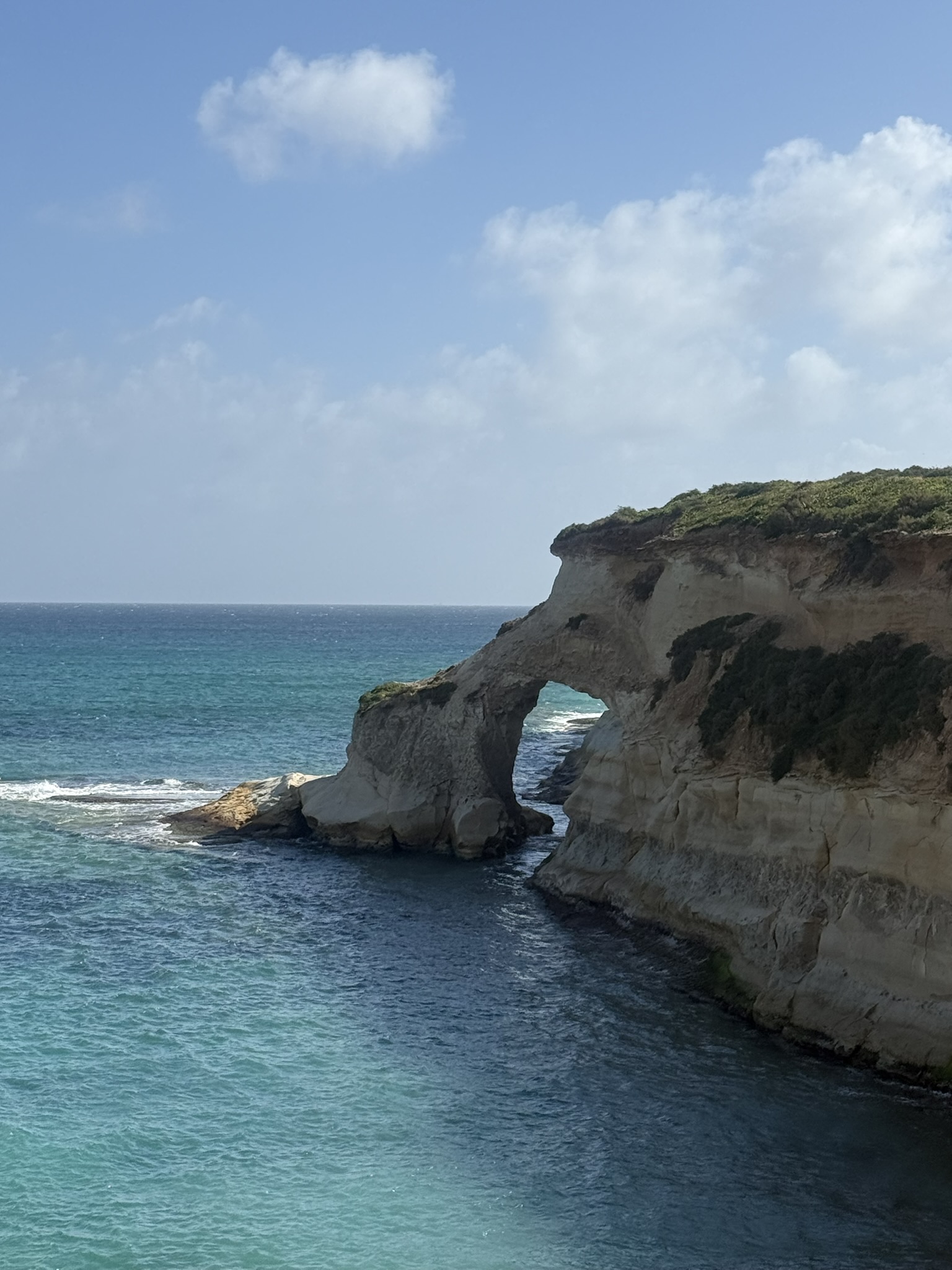


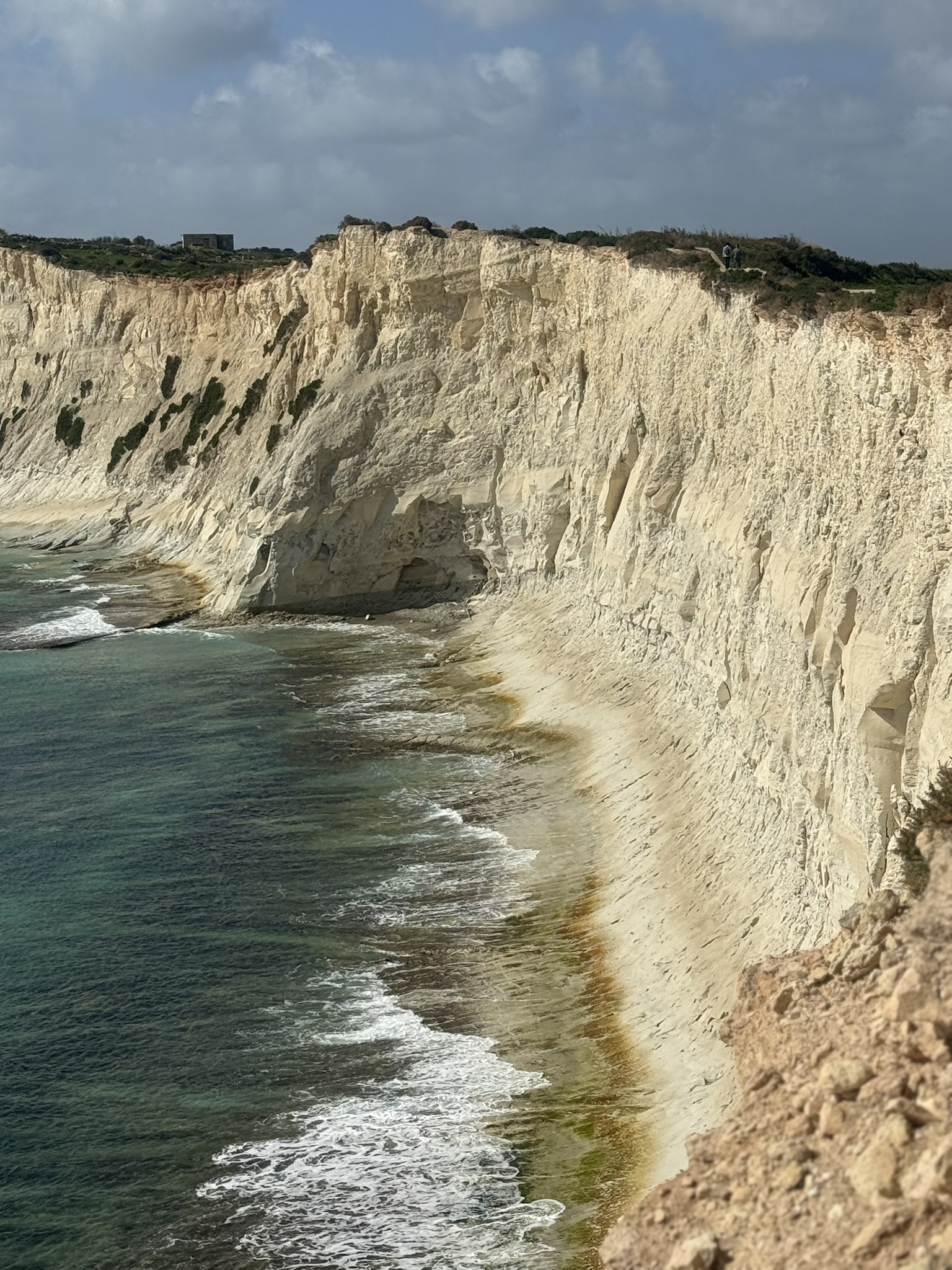


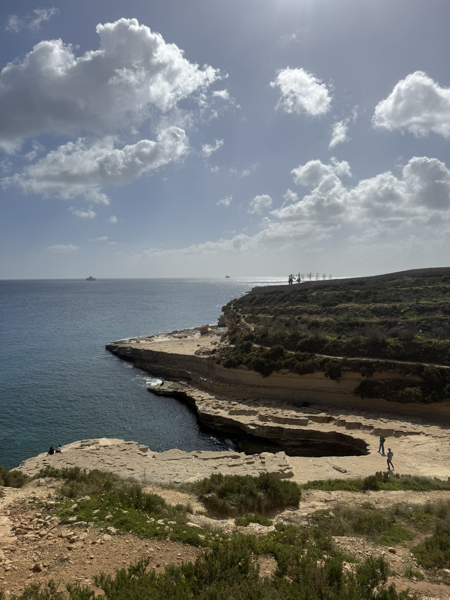


I like how quickly the coast changes while keeping the same geological story. Munxar Window is the obvious landmark, but only the first example of erosion here.
Then come pale cliffs, Munxar Point and St Peter's Pool before the coast folds into the more enclosed Ħofriet.
That sequence is why I would walk southbound: St Thomas Bay eases you in, Munxar Window provides the first landmark, and Ħofra l-Kbira feels like a proper finish.
Munxar to Ħofriet is a compact lesson in Malta's softer coastline: a natural window, pale Globigerina Limestone and two coves cut into the island. It is short, but the geology gives it a clear beginning, progression and finish.
Malta's geological survey explains the limestone and erosion, while Wikiloc provides route orientation and the Munxar Window reference adds landmark context.