A cavity grows below ground
Rainwater slowly dissolves limestone along joints and fractures. Over time, a subterranean void develops beneath the surface.
Il-Maqluba is one of Malta's most dramatic inland landforms - a vast limestone collapse hidden beside the village of Qrendi.
Its name means "the overturned", an apt description for a site where the limestone roof above an underground cavity collapsed and left a steep-sided doline behind.
Today the hollow is both geological monument and protected habitat. Dense vegetation fills its sheltered interior, while the old and new chapels of San Mattew stand almost on the rim, binding geology, ecology, history and local legend into one compact site.
The science begins underground, but Il-Maqluba's human story runs through medieval tradition, farming, folklore and modern conservation.
Rainwater slowly dissolves limestone along joints and fractures. Over time, a subterranean void develops beneath the surface.
The formation of the present sinkhole is traditionally dated to the night of 23-24 November 1343, during a severe storm. The exact historical trigger remains less certain than the collapse process itself.
Gian Francesco Abela described the great pit and cultivation within it. The sheltered floor later supported crops, with traces of past agricultural use still visible.
Il-Maqluba was scheduled for its ecological and scientific importance, recognising both its geology and the habitats established within the depression.
A conservation order and later international SAC designation strengthened protection of the doline and its characteristic habitats.
Local tradition tells of a sinful settlement swallowed by the earth while a devout woman praying nearby survived. It is folklore rather than geology, but it remains inseparable from the identity of the place.
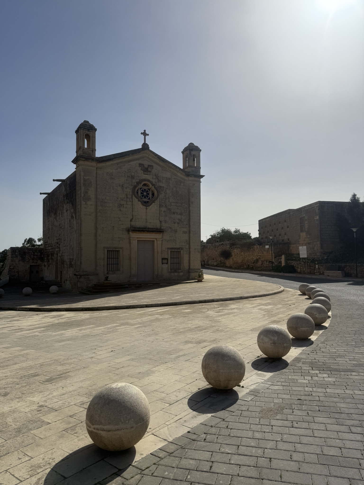
San Mattew tal-Maqluba stands directly beside the sinkhole. The smaller chapel and crypt are thought to pre-date the 15th century, while the larger church was built between 1674 and 1682. Misraħ tal-Maqluba was embellished in 2013, turning the space between church and sinkhole into a quiet village square that frames the site before you even reach the rim.
Long before most visitors hear the geological explanation, Il-Maqluba is introduced through a darker story - one of warning, punishment, survival and a village supposedly torn from the land.

Local tradition speaks of a community at Ħal-Lew whose inhabitants ignored repeated warnings to change their ways. The earth then opened beneath the settlement, swallowing it while sparing a good woman living nearby.
The story continues beyond the sinkhole: angels are said to have carried the fallen village out to sea and cast it down, creating Filfla off Malta's south coast. It is folklore, not a geological account, but it has become inseparable from the way Il-Maqluba is remembered.
The geological explanation is a limestone collapse doline; this section presents the traditional Qrendi legend associated with it.
Il-Maqluba is a short stop, but it rewards a slower visit. Start with the chapels, then read the landform from the rim before focusing on the life growing inside it.
The older chapel and larger 17th-century church sit almost on the edge of the doline.
The scale is easiest to understand before you focus on individual rock faces or plants.
The exposed rock makes the mechanics of a collapse doline much easier to visualise.
Access warning: The path that once led down into the basin has since been closed. Do not attempt to descend; respect all barriers and current access restrictions.
The site is protected for ecology as well as geology, so observe from permitted areas and leave the floor undisturbed.
From Misraħ tal-Maqluba and St Matthew's Chapel to the rim, the closed descent and the collapsed basin below.


There is something about Il-Maqluba that feels almost mythical to me. Even before looking down into the sinkhole, the old church, the quiet square and the sudden drop in the earth make the place feel detached from the countryside around it.
That feeling became much stronger after hearing the legend. Knowing the story of a village supposedly swallowed whole, with its remains carried out to sea to become Filfla, gives the landscape an atmosphere that the geology alone cannot quite explain. I know it is folklore, but standing at the rim, it is very easy to understand why a place like this inspired a story like that.
ERA documents Il-Maqluba as Natura 2000 site MT0000004 and identifies its protected laurel, rocky-slope and sandarac-gum habitats. Qrendi Local Council covers the site's local history, legend and the neighbouring San Mattew chapels. The retained collapsed-basin photograph is by Frank Vincentz via Wikimedia Commons (CC BY-SA 3.0); the aerial view is sourced from GuideMeMalta.