Mġarr ix-Xini Bay
Mġarr ix-Xini feels less like a conventional beach and more like the flooded mouth of a limestone gorge.
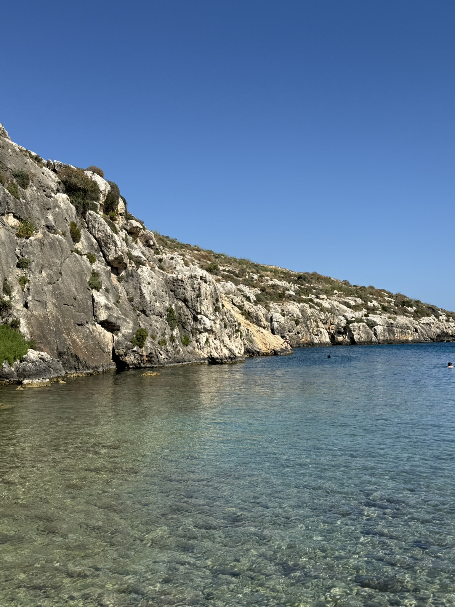
Cut into Gozo's southern coast between Xewkija and Ta' Sannat, Mġarr ix-Xini sits at the seaward end of a deep, steep-sided valley. The inlet is long and narrow, with pale limestone walls drawing the eye from the small shingle beach towards open water.
The sheltered setting has made it useful for centuries. Galleys once sought refuge here, raiders used the inlet during one of Gozo's darkest episodes, and a coastal tower was later built above its mouth. Today the same geography makes the bay popular for swimming, snorkelling and shore diving.
Beach profile
- Site
- Mġarr ix-Xini Bay
- Coordinates
- 36.02032° N, 14.27140° E
- Type
- Sheltered shingle cove
- Coast
- Southern Gozo
- Setting
- Deep limestone valley
- Facilities
- Limited & seasonal
- Access
- Road, footpath, kayak or boat
- Best for
- Swimming, snorkelling & diving
From galley refuge to guarded bay
The shape of Mġarr ix-Xini made it a useful landing place long before it became a swimming spot.
A natural harbour
The narrow inlet offered shelter from open water and is traditionally associated with the galleys of the Knights of St John.
Gozo's great raid
Invading Ottoman forces used Mġarr ix-Xini to embark Gozitan captives after the devastating 1551 raid on the island.
The tower takes watch
The coastal tower was functioning by June 1661, watching the inlet and communicating with other defensive positions across the Gozo-Comino channel.
Restoration
Wirt Għawdex and the Ministry for Gozo restored the badly deteriorated tower, reopening it to the public in July 2009.
A film set
The bay became the principal setting for By the Sea, filmed in Gozo with Angelina Jolie and Brad Pitt.
A gorge that opens into the Mediterranean
The beach is only the final few metres of a much larger valley landscape.
A valley cut along lines of weakness
Wied ta' Mġarr ix-Xini is a steep-sided, meandering gorge incised into Lower Coralline Limestone. Geological faulting created zones of weakness that helped guide the valley towards the coast, where it continues as the narrow marine inlet.
The result is one of Gozo's most distinctive transitions from countryside to sea: terraced land and a dry valley upstream, a tight limestone corridor near the coast, then a small shingle beach facing the sheltered water.
The limestone gorge
Steep rock walls, caves and karst features give the approach an enclosed feel long before the sea comes into view.
A small shingle beach
The beach is compact and storm-shaped, with pebbles and cobbles rather than a broad strip of sand.
The guarded mouth
The inlet widens towards open water, with Mġarr ix-Xini Tower standing above the western side of the entrance.
What shapes the scene
Mġarr ix-Xini is a meeting point between geology, freshwater runoff, historic land use and a sheltered marine environment.
A simple Mġarr ix-Xini visit
Give yourself enough time to enjoy the beach and water, then walk out towards the tower rather than treating the bay as a quick roadside swim.
Take the valley road slowly
The descent is part of the experience, but the final road is narrow and enclosed.
- Approach from Xewkija or Ta' Sannat and follow signs towards Mġarr ix-Xini.
- Expect a narrow winding road with limited room in places.
- In peak summer, arrive earlier in the day to make parking and turning easier.
Settle at the head of the inlet
The shore is small, pebbly and closely framed by the valley sides.
- Choose a spot above the wash of the water and away from vehicle movement.
- Bring water and sun protection even if a seasonal outlet appears to be operating.
- Look back inland to appreciate how abruptly the valley narrows behind the beach.
Follow the rocky margins
The best sense of the inlet comes from looking back at its walls from the water.
- Check the sea state, jellyfish and boat activity before entering.
- Snorkel along the rocky sides rather than pushing straight out towards the mouth.
- Keep clear of divers' bubbles, marker buoys and any boat traffic using the inlet.
Finish above the entrance
A restored path links the bay with the historic tower overlooking the mouth of the inlet.
- Follow the established path from the bay towards Mġarr ix-Xini Tower.
- Pause above the inlet for the best view of its long, narrow shape.
- Remember that tower opening is limited to selected days rather than guaranteed daily access.
Around Mġarr ix-Xini
My photographs from Mġarr ix-Xini alongside selected Wikimedia context images of the bay, tower and valley landscape.




Mġarr ix-Xini in motion
From the calm surface to the life hiding in the shallows.