Literally, 'the little garden'
Ġnejna is the diminutive of ġnien, meaning garden - fitting for the sheltered, historically fertile valley behind the bay.
The distance barely explains this hike.
Between Ġnejna and Golden Bay, the north-west coast folds through beaches, clay ridges and exposed headlands. It is short on paper, but constant terrain changes make it feel far more substantial.
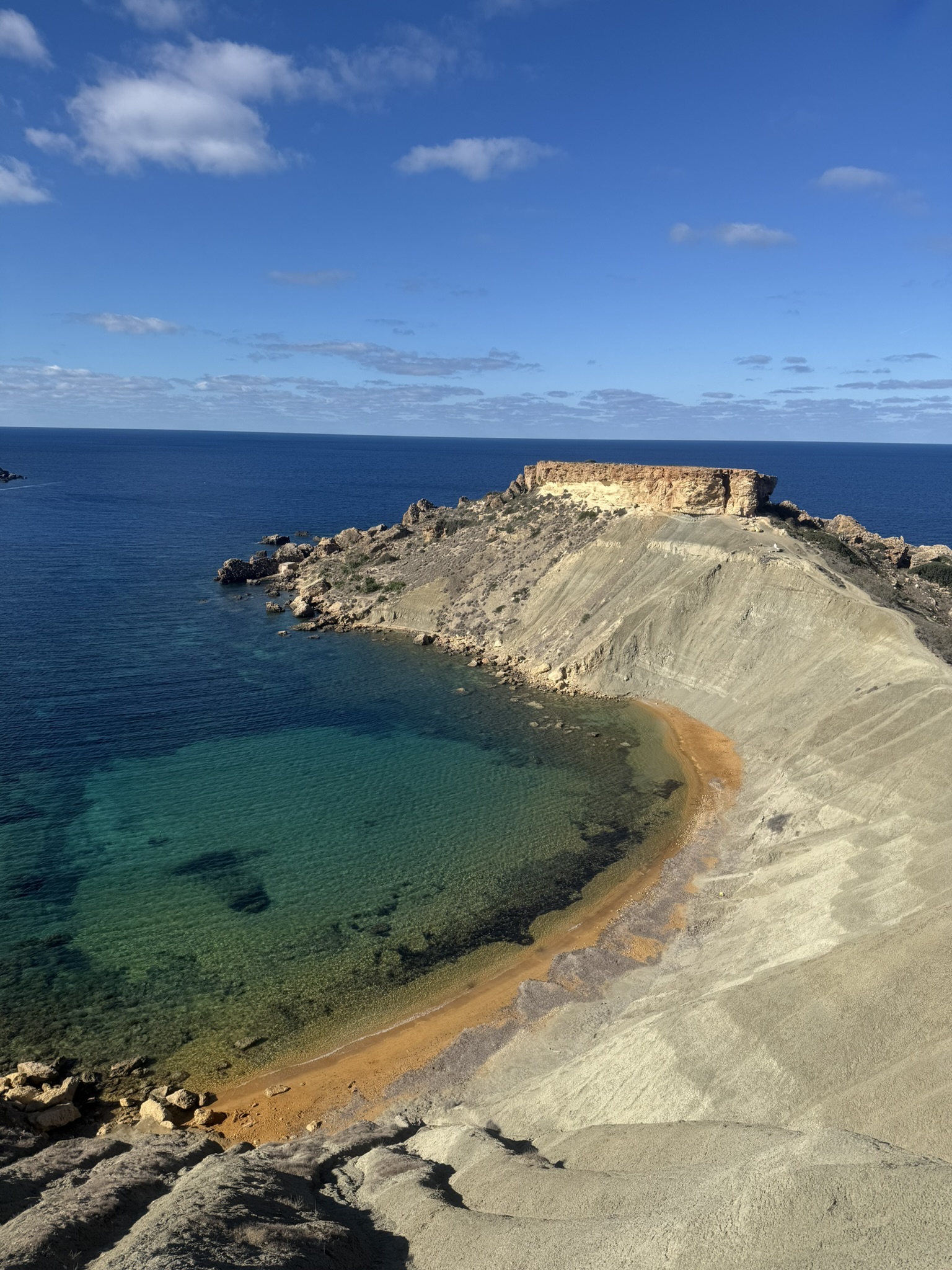
Starting at Ġnejna puts the blue-grey clay slopes first, before the route contours towards Qarraba Bay, crosses Il-Qarraba to Għajn Tuffieħa and climbs towards Golden Bay.
The appeal is the sequence: Ġnejna behind you, clay underfoot, Qarraba opening beside the trail and each bay giving way to the next.
These names preserve clues to gardens, springs, the headland and Golden Bay's older Maltese identity.
Ġnejna is the diminutive of ġnien, meaning garden - fitting for the sheltered, historically fertile valley behind the bay.
The origin of Qarraba is uncertain. One interpretation links it to a fish name, perhaps describing the flat-topped headland's shape. It remains a proposed rather than definitive etymology.
Għajn means spring and tuffieħa means apple, giving the usual reading 'the spring of the apple'. The name is recorded as early as 1299, though its exact historical reference is uncertain.
Golden Bay's older Maltese name is Ir-Ramla tal-Mixquqa - roughly 'the sandy bay of the cracked or split promontory', a name rooted in the coastal landscape rather than the sand's colour.
The trail is informal and erosion shifts the safest line, so follow landmarks rather than expecting one fixed path.
Leave Ġnejna and climb onto the pale clay below Il-Qarraba. The road disappears quickly. Dry clay can be dusty and loose; after rain it becomes exceptionally slippery and unstable, so conditions should decide whether you continue.
Cross blue-grey clay ridges and shallow gullies above the sea. This is the wildest stretch, with excellent views back towards Ġnejna. Move slowly because erosion continually reshapes the informal path.
Il-Qarraba is the hinge between Qarraba Bay and Għajn Tuffieħa, with the route's strongest exposure and some of its best views. In strong wind or poor visibility, stay well back from the edge and avoid eroded lines.
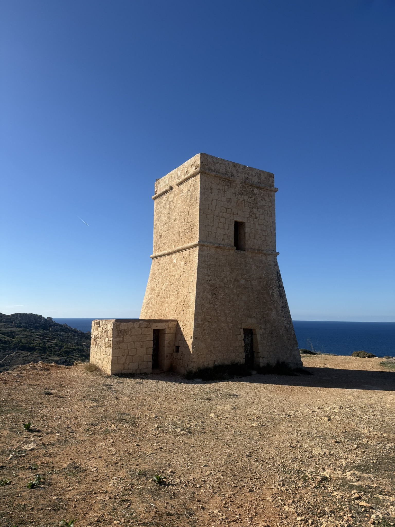
Climb past Għajn Tuffieħa Tower towards Golden Bay. The terrain becomes easier and more defined, finishing with a broad view over the bay and easy access to food, buses or a swim.
To extend the hike, retrace the coast to Ġnejna or loop inland via Manikata. The inland option adds road sections and feels less wild.
It is short, but clay and exposure matter more than distance.
Plan your return before setting off.
The clay is the deciding factor.
Cool, dry weather is ideal.
Light hiking kit is enough in good conditions.
From Ġnejna's clay slopes through Qarraba and Għajn Tuffieħa to Golden Bay.






This is probably the Malta hike I have done most often, yet the sequence of Ġnejna, the clay trail, Il-Qarraba, Għajn Tuffieħa and Golden Bay still impresses me. It packs an extraordinary amount of scenery into a short stretch of coast and remains my first recommendation for a compact, unmistakably Maltese introduction to the west coast.
Geology, landscape and route context for Ġnejna, Il-Qarraba, Għajn Tuffieħa and Golden Bay.