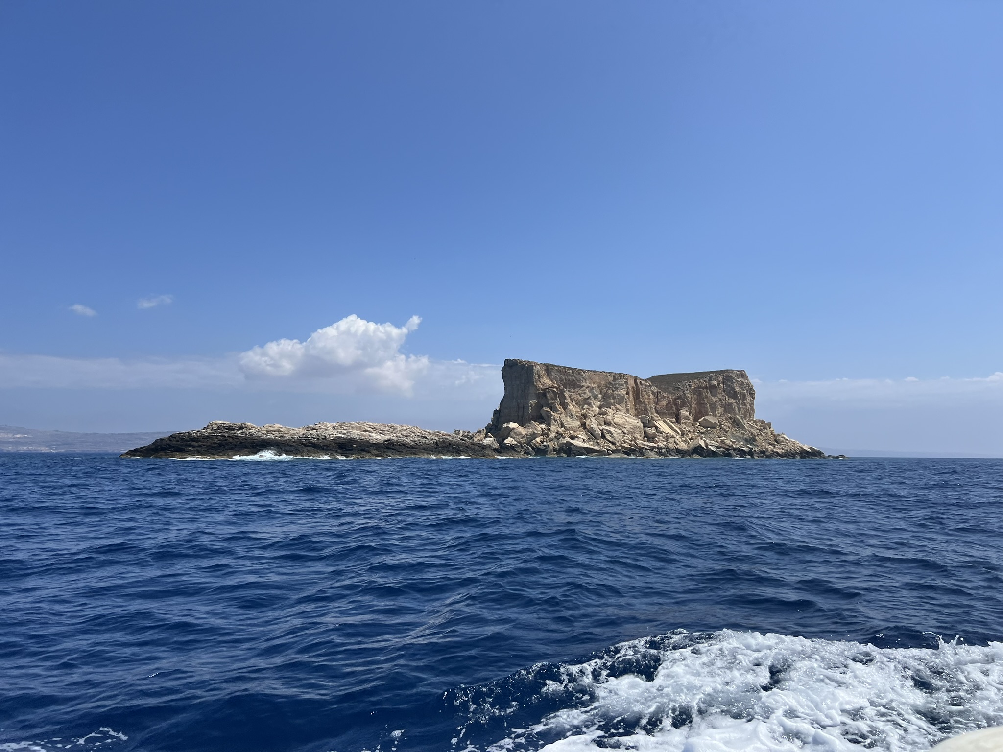
Filfla Offshore Reef
Filfla is an isolated underwater landscape of limestone, boulder slopes, sand and sudden depth - with the entire dive shaped by its remoteness.
Roughly five kilometres off Malta's south-western coast, Filfla rises from deep water as a flat-topped limestone islet. Its name is thought to derive from the Arabic felfel, meaning peppercorn, while older charts called it “Pepper” island.
Just south-west lies Filflett, or il-Ġebla ta’ Xutu, the smaller rock marking the southernmost point of the Maltese archipelago. Filfla itself is not open to ordinary recreational diving: I dived it with Sharklab-Malta under special authorisation for Bombs to Batoids.
Site profile
- Coordinates
- 35.7868° N, 14.4090° E
- Dive type
- Offshore reef · Slope · Drop-off
- Experience
- Advanced · current experience
- Access
- Specially authorised boat dives only
- Distance from shore
- ~5 km
- Depth
- ~20-40 m typical
- Reef depth
- Continues beyond 70 m
A nature reserve shaped by decades of bombardment.
Filfla's landscape is inseparable from its military past. Decades as a target range scarred the cliffs and left evidence scattered across the seabed.
Target island
Filfla was used for military target practice by successive forces. Bombing and gunnery exercises intensified during the mid-20th century, physically altering the cliffs and surrounding rocky debris.
The firing stops
Target practice ended in the early 1970s, but the seabed retained the evidence: spent ammunition, unexploded ordnance and a landscape of broken rock beneath the cliffs.
Nature reserve
The Filfla Nature Reserve Act established stronger legal protection for the islet, reflecting its importance for wildlife and the need to minimise human disturbance.
Protection and research
Filfla and its surrounding waters form part of a highly protected marine and terrestrial environment. Authorised scientific dives have helped reveal how significant the area can be for rays, skates and other marine life.
Boulders, slope, sand - then suddenly much deeper blue.
Filfla is best understood as a sequence of terrain changes rather than one fixed route. The exact profile depends on the authorised drop point, the side of the island and what the current allows on the day.
Collapsed limestone below the cliffs
Large and medium-sized boulders dominate parts of the shallower seabed, creating shelter, ledges and gaps while making visual navigation surprisingly repetitive.
The island keeps falling away
The bottom can begin gently before steepening offshore. Some sections descend towards 50 metres and beyond, with the broader reef system continuing past 70 metres.
Where the wildlife search changes
The reef-sand boundary is especially worth watching. Rays and skates are easily missed when divers only scan the rock directly in front of them.
From Bombs to Batoids
I dived Filfla with Sharklab-Malta through Bombs to Batoids, an authorised citizen-science project studying elasmobranchs around the reserve. Across ten survey dives, 164 individual skates and rays were recorded. Beyond the batoids, what struck me was how large much of the reef life seemed.
At Filfla, the plan starts with permission - then the current.
There is no universal route around Filfla. These profiles describe ways to think about an authorised dive, not instructions for independent access.
Approach
Permission, briefing, current and boat recovery come before the underwater route.
- Confirm that the dive is being conducted under the required authorisation and within the conditions of the permit or research programme.
- Brief the exact side of the island, drop point, current direction, maximum depth, DSMB procedure and pickup strategy before entering.
- Enter and descend as a compact group. Offshore current can separate divers before the reef is reached if the team is loose from the start.
- Treat any shells, bombs or other military ordnance as untouched historical material. Do not handle, move or investigate it closely.
Boulder-slope circuit
A controlled recreational profile using broken limestone and the sand boundary as the main visual references.
- Descend from the authorised boat drop as a group and establish the reef orientation early.
- Keep a compass heading. Repeated boulder fields can look far more distinctive on the way out than on the way back.
- Follow the slope to the agreed maximum depth, watching the sand margin as carefully as the rocks for rays and skates.
- Begin the return before gas or no-decompression time becomes limiting, using progressively shallower terrain.
- Deploy the DSMB as briefed and complete the ascent where the boat can track and recover the team safely.
Drop-off profile
For teams specifically briefed for a steeper section of reef and comfortable managing depth beside open blue water.
- Confirm the current direction, maximum depth and pickup strategy before entering.
- Descend on the reef rather than free-falling into open water, using the slope or wall as a visual depth reference.
- Spend the deepest part of the dive early and resist following the terrain simply because it continues below the plan.
- Work progressively shallower while checking ledges and adjacent sand instead of staying fixed to the wall.
- Leave enough reserve for a free-water ascent and possible surface drift while the boat closes in for pickup.
Wildlife-focused profile
Slow the dive down and treat the reef-sand boundary as habitat rather than scenery.
- Start with the site's authorised descent and orientation, then establish a slow search line along the reef-sand transition.
- Scan ahead for silhouettes and movement on the sand before swimming directly over an animal and losing the encounter.
- Alternate between open substrate and boulder bases, where morays, lobster, scorpionfish and octopus can be easy to miss.
- Keep the group compact. A wildlife dive becomes inefficient quickly when every diver is searching in a different direction.
- Finish shallow and leave the animals undisturbed.
Filfla, frame by frame.
Filfla and Filflett above water, the reef below, and the marine life that made the research dives unforgettable.
Filfla from above
Four photos