‘The saw’
Munxar is an old Maltese word for a saw, fitting the sharp headland beyond St Thomas Bay.
A south-east coast paddle where the landmarks keep changing: cave, arch, open headland, twin coves and a final natural pool.
This loop leaves St Thomas Bay for Munxar Window, Irsejjen Cave and the open coast before reaching the Ħofriet.
The Wikiloc loop is 9.93 km, passing Munxar, the two Ħofriet and St Peter’s Pool. Distance is manageable, but wind, swell and cliff rebound determine the real difficulty.
Transport Malta currently restricts areas around Munxar Window and Il-Munxar because of falling-rock danger. Stay outside the marked zones and view the window from offshore. Read the notice.
Some of the route’s names describe the shape of the land almost literally; others are less certain.
Munxar is an old Maltese word for a saw, fitting the sharp headland beyond St Thomas Bay.
Ħofriet, plural of ħofra (hole or pit), refers here to Ħofra l-Kbira and Ħofra ż-Żgħira.
Ras means head or headland and fenek means rabbit: the narrow point dividing the two Ħofriet.
The rounded inlet and flat limestone shelves explain the ‘Pool’; the origin of ‘Peter’ is less certain.
The route below follows the main waypoints. Keep clear of caves, arches or cliffs whenever notices, rockfall or sea state make them unsafe.
Launch from St Thomas Bay and follow the coast towards Il-Munxar. Keep outside the current restricted area around the window.
Continue beyond Munxar towards Irsejjen Cave, approaching only when the sea is calm and the entrance is free of surge and traffic.
Leave the cave and continue along the exposed limestone coast towards the first of the two Ħofriet.
Cross Ħofra l-Kbira, round Ras il-Fenek and enter Ħofra ż-Żgħira before reassessing conditions for the final leg.
Continue towards St Peter’s Pool, giving swimmers and boats plenty of room around the inlet.
The return completes the roughly 10 km loop. Recheck wind, swell and daylight before heading back.
The Wikiloc line is hand-drawn, so use it for orientation rather than exact navigation.
Globigerina Limestone dominates this coast, where erosion has carved platforms, caves, windows and rounded coves.
Soft, fine-grained Globigerina Limestone helps create the smoother, lower shoreline seen across south-east Malta.
Waves exploit joints and softer layers, gradually forming notches, caves and arches such as Munxar Window.
Ħofra l-Kbira and Ħofra ż-Żgħira are divided by Ras il-Fenek, creating a sheltered break in an otherwise open coast.
That erosion also creates rockfall risk. Transport Malta’s September 2026 notice names restricted areas around Munxar Window and Il-Munxar.
The 9.93 km distance is only part of the challenge: exposure, wind, traffic and restricted zones matter more.
St Thomas Bay keeps the start and finish simple.
The bay can look calmer than the coast outside it.
Calm water beats a fixed calendar date.
Enough for a half-day coast paddle.
From St Thomas Bay to Munxar Window, Irsejjen Cave, the two Ħofriet and St Peter’s Pool.


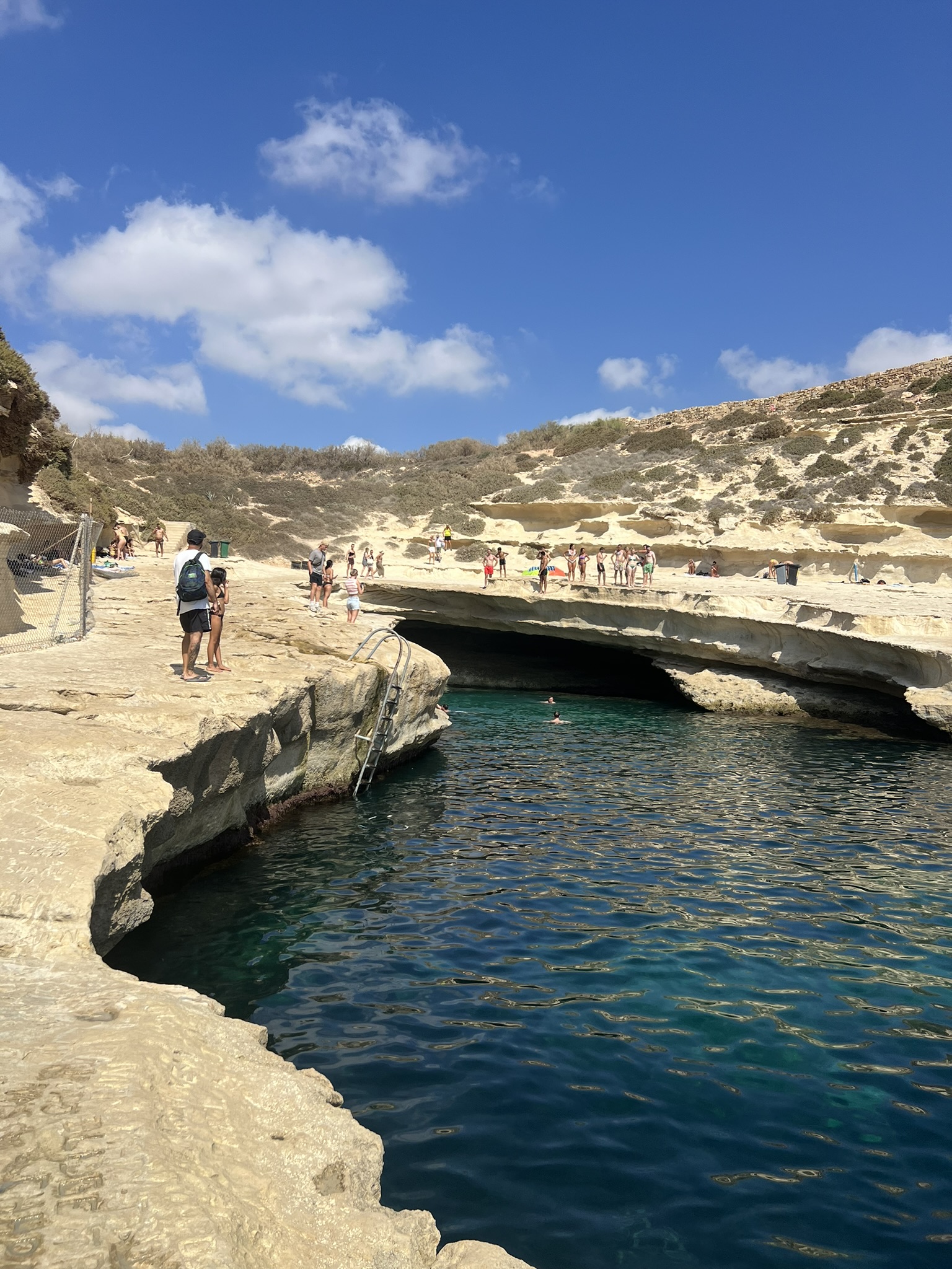

The same route sequence, from Munxar Window through the cave and Ħofriet to St Peter’s Pool.
The appeal is the progression: sheltered St Thomas Bay, Irsejjen Cave, dramatic Munxar and then the open coast folding into the Ħofriet.
St Peter’s Pool marks the turn home. It is a substantial outing without being an expedition, but wind, rebound, rockfall and boat traffic can quickly change the plan.
The recorded line, current navigation restriction, local kayak context and Malta’s geological background.