Layers form beneath the sea
Marine sediments accumulated over millions of years, eventually forming Malta's familiar sequence of limestone and Blue Clay.
A small wild cove below sculpted Blue Clay slopes - hidden between some of Malta's best-known beaches, but with a character entirely of its own.
Qarraba is tiny, exposed and completely unlike the organised beaches only a short distance away.
Tucked around the Il-Qarraba headland on Malta's north-west coast, Qarraba Bay sits below steep grey-blue clay slopes between the wider landscapes of Għajn Tuffieħa and Ġnejna. There is no road to the sand, no line of umbrellas and no beach infrastructure waiting at the bottom.
What you get instead is a compact crescent of shore, clear Mediterranean water and one of the island's most distinctive geological backdrops. The approach is part of the experience: the bay gradually appears beneath the layered headland as the coastal paths drop towards the water.
The bay is shaped by the same layered geology that gives north-west Malta its cliffs, clay slopes and unstable-looking headlands.
Marine sediments accumulated over millions of years, eventually forming Malta's familiar sequence of limestone and Blue Clay.
Blue Clay sits beneath harder Upper Coralline Limestone. When exposed, it weathers into smooth talus slopes and becomes plastic when wet.
As the islands rose and the coast eroded, the stacked formations were exposed, leaving hard limestone caps above softer ground.
The contrast between rigid limestone and ductile clay encourages slope movement, spreading and local instability around the promontory.
Erosion is part of what makes Qarraba so striking, but it also means visitors should avoid steep clay faces and unstable cliff edges.
Il-Qarraba is first and foremost the name of the promontory separating Għajn Tuffieħa from Ġnejna. Its origin is uncertain, but one Maltese etymology source suggests it may come from karraba/qarraba, a fish name, because the rocky headland resembles one when viewed from above.
The grey-blue slopes are not weathered limestone. They are Malta's Blue Clay Formation, a soft geological layer that erodes readily and becomes slippery after rain.
The beach is small, but the landscape around it tells a much bigger story.

The small beach lies at the foot of steep clay slopes beneath the Il-Qarraba promontory. The harder limestone cap remains above while the softer clay below is continually reshaped by weather and gravity.
That contrast gives the bay its enclosed feel: turquoise water in front, smooth grey slopes behind and a flat-topped headland pushing out towards open sea.
Qarraba Bay. Tap to open full-screen.
The usable strip of sand is small, so Qarraba feels much more intimate than neighbouring Għajn Tuffieħa or Ġnejna.
Rain and runoff carve the soft clay into ribs and gullies. After wet weather the same slopes can become extremely slick.
The limestone-capped promontory frames the bay and is one of the defining landforms of the Għajn Tuffieħa landscape.
Qarraba is a meeting point between geology, sea and a thin strip of beach habitat.
Qarraba rewards a little effort, but its remoteness also means taking more responsibility for your own visit.
On a settled day the cove can be an excellent swimming stop, but there are no facilities or lifeguard services at the beach itself. Wind, swell and jellyfish conditions can change quickly.
Check the sea before committing to the descent and keep enough energy - and daylight - for the climb back out.
The wider Għajn Tuffieħa and Qarraba area is protected for its landscape, habitats and geology. The management plan specifically recognises the scenic importance of the Qarraba isthmus and the relatively pristine character of Il-Qarraba.
Stay on established paths where possible and do not cut steps into the clay or disturb slope vegetation.
Natural accumulations of Posidonia leaves on the shore are part of the beach ecosystem. Management guidance for the area specifically allows these banquettes to remain on the Qarraba side so the communities they support can persist.
There is no formal beach entrance, so think of Qarraba as a short coastal outing with a swim at the bottom rather than a conventional beach stop.
Use established paths around the Il-Qarraba landscape and avoid improvising a direct descent.
The shore is small, simple and completely exposed to the elements.
The bay is at its best when the sea is settled.
The climb is part of the visit, especially after a long swim.
Twelve views from the descent, headland and shoreline around Qarraba Bay.


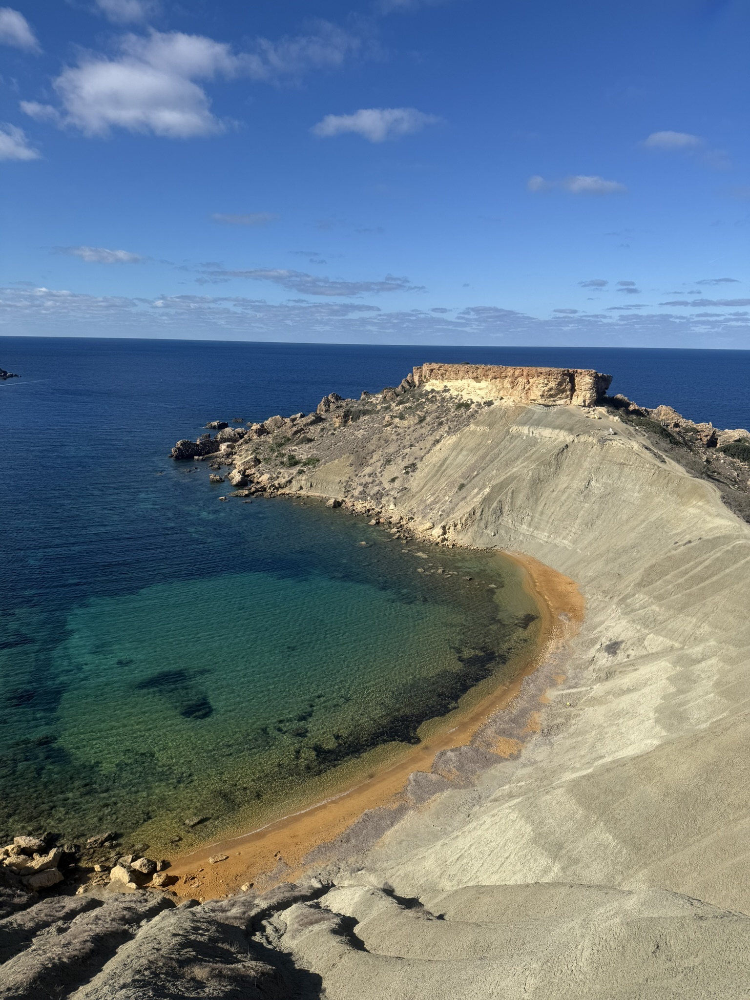


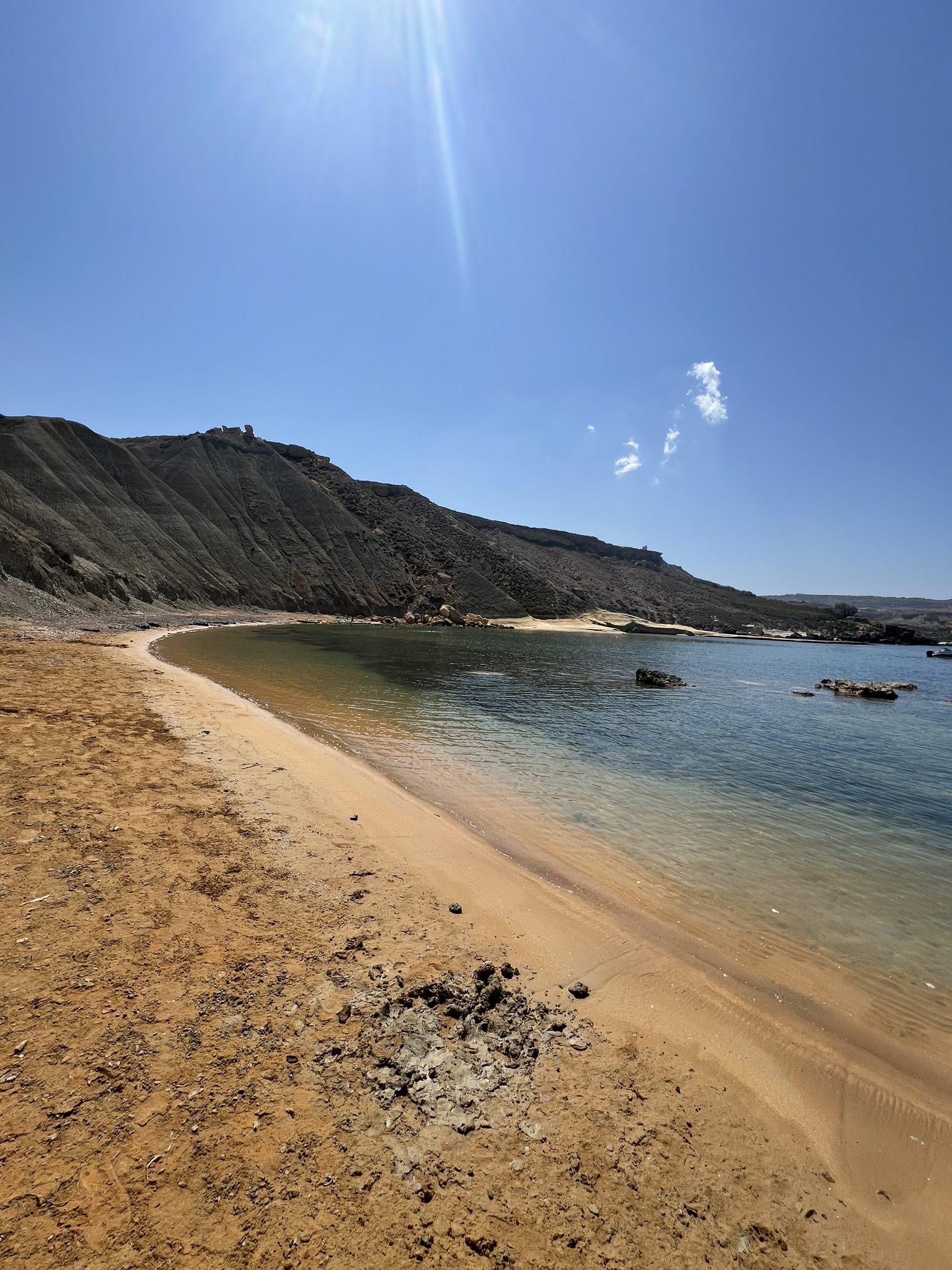
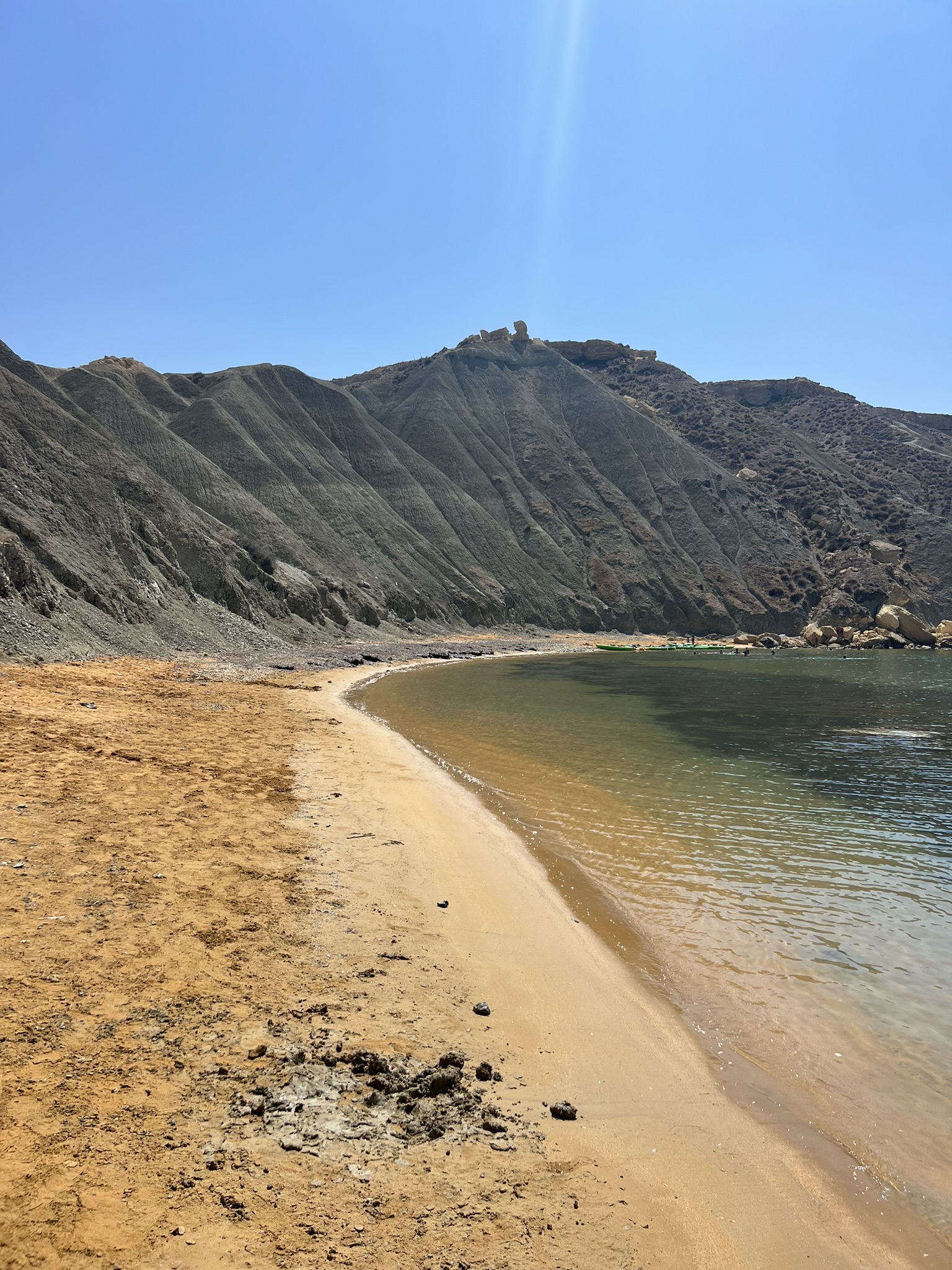


Qarraba Bay is one of my favourite beaches in Malta. There is something almost impossible about the colour of the sand here - a deep, burnt orange that feels completely different from the pale limestone landscape around it.
What I love most, though, is how remote it feels. Getting there takes a little more effort than simply stepping out of a car, and that keeps the crowds away. Even in good weather, there are usually far fewer people here than at the more accessible bays nearby.
You can reach Qarraba on foot as part of a coastal trek, or approach it from the sea by kayak. Either way, it makes for a brilliant stop - somewhere to swim, rest for a while and enjoy one of the most striking little corners of Malta's west coast before continuing on.
ERA's Għajn Tuffieħa management material is the main reference for the landscape, access and conservation context. University of Malta research provides additional geological context for the Blue Clay and Qarraba promontory.