Antarctic Peninsula – Day 3: The Lemaire Mirror
ANTARCTIC PENINSULA
Day 3: The Lemaire Mirror
March 09, 2023
PART I
We woke up to a typical Antarctic day, winds high and gusting, the sky overcast, and the sunrise painting the mountains and clouds in shades of yellow and orange. By this point, it felt like we’d fallen into a rhythm – breakfast, bow, mudroom, landing.
With the water so rough, even getting aboard the Zodiac was a feat. This time round, a few people opted out of the expedition altogether. George, who’d previously been criticising that Swiss lady for missing a landing because of the weather, found himself too hungover to even consider going out. Talk about double standards, huh? Well, no skin off my back. I would’ve gone even if they’d told us there was a huge chance of dying.
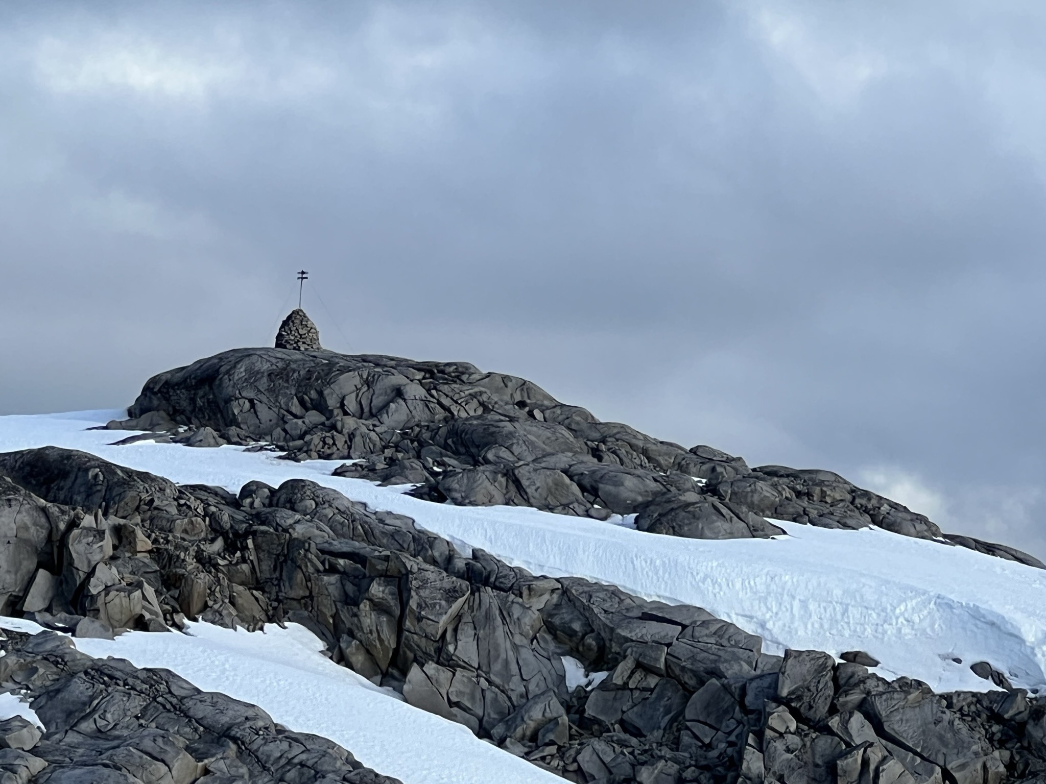
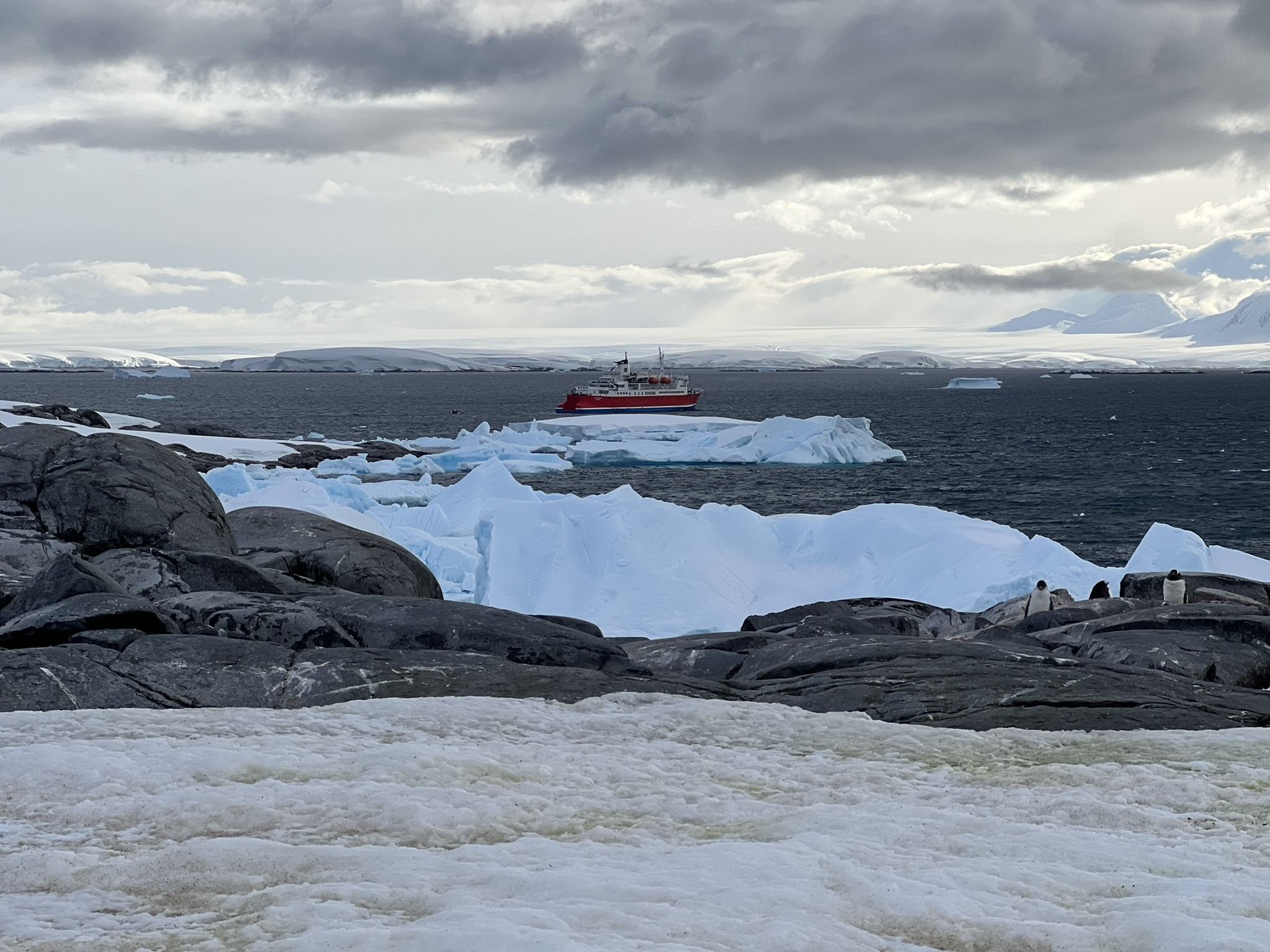
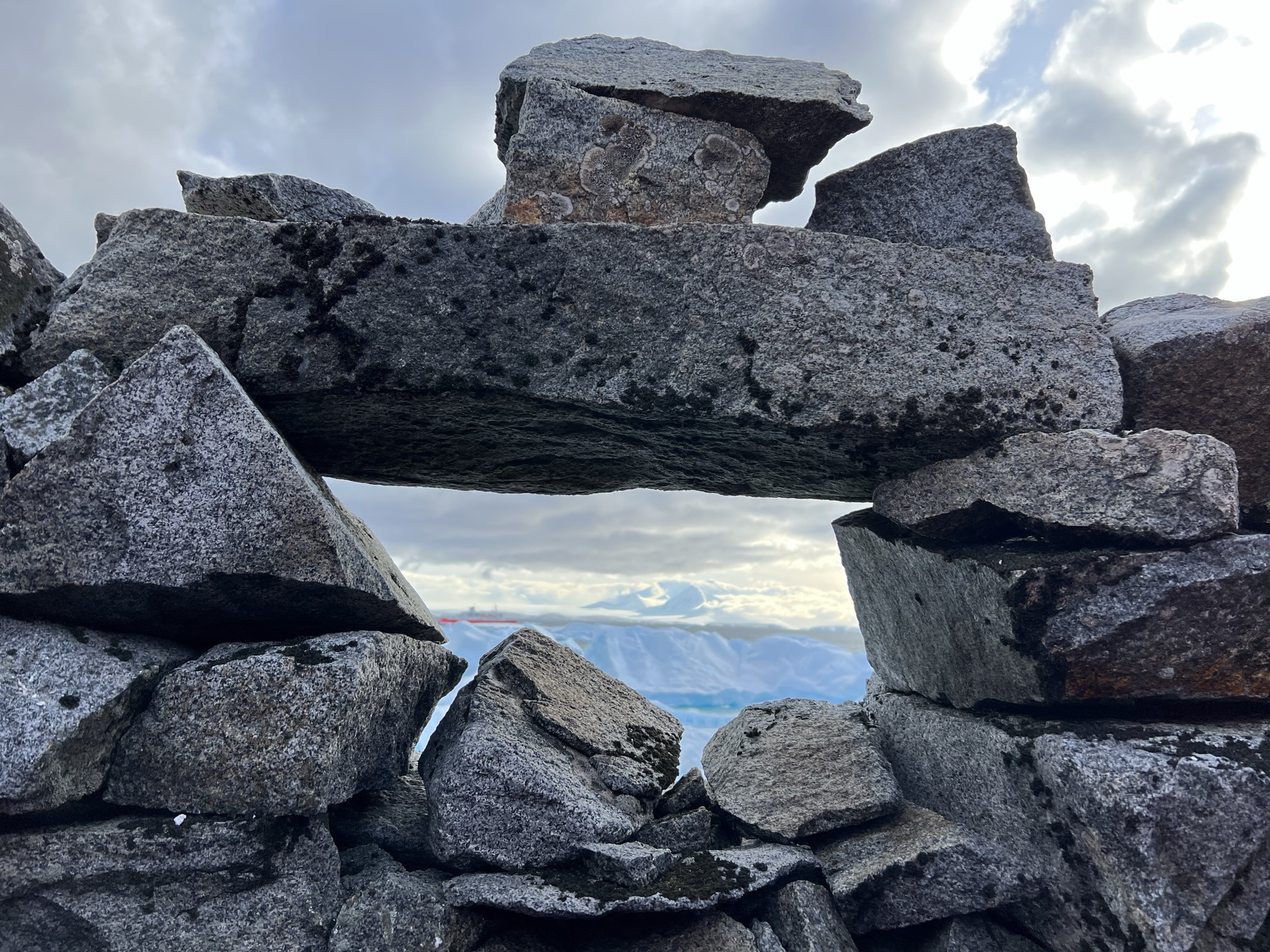
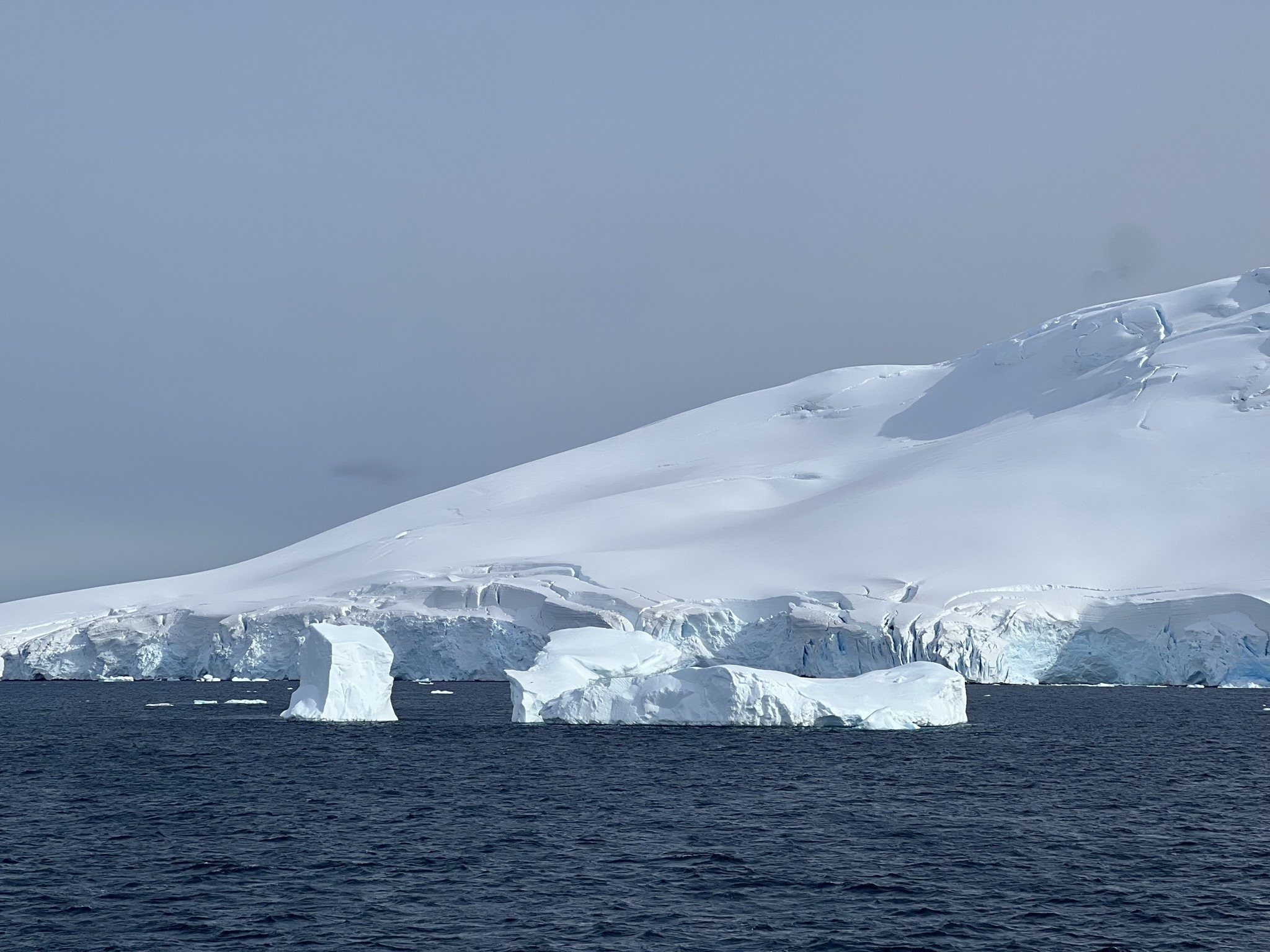
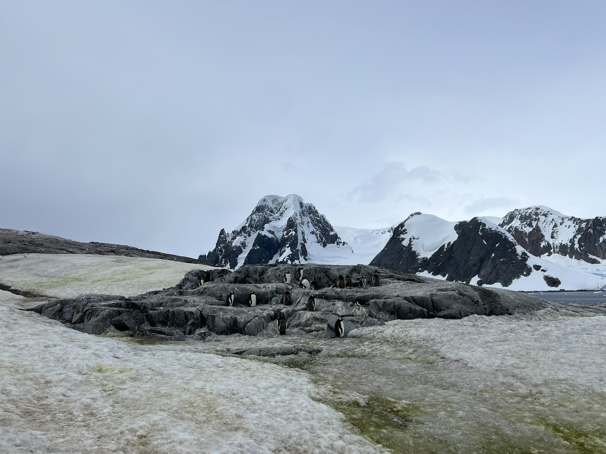
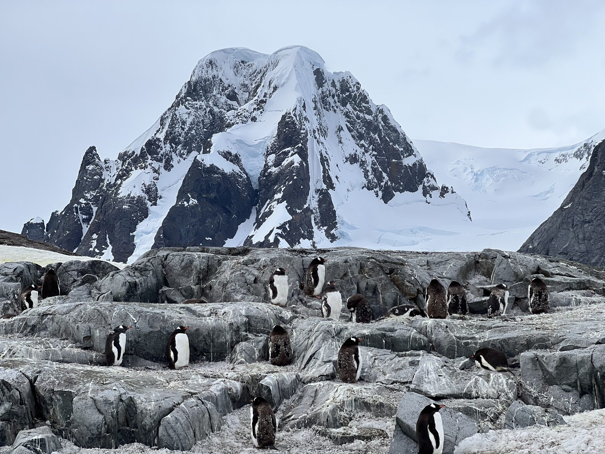
Our first expedition would be on Booth Island, an eight-kilometre-long, Y-shaped island forming the western side of the Lemaire Channel. Apart from the gentoo colonies, our main interest was Port Charcot, a bay at the northern end of the island where Jean-Baptiste Charcot overwintered aboard the ship Français during his expedition to chart the region. Here, the team built a cairn and left supplies as an emergency refuge. Standing alone above the bay is the stone cairn Charcot constructed, topped with a wooden post and a plaque bearing his name. Not far from there is the small stone “observatory”, a dry-stone shelter with a narrow opening that frames an impressive view across the bay towards the massif later named Mount Français.
Onto Booth Island
Our landing was nothing like we expected. Mostly because, despite the harsh wind, the sun finally punched through the cloud, turning the snow into a blinding sheet of glitter as the light ricocheted off its surface. Conditions would’ve been ideal, were it not for the gallon of icy water that found its way through my waterproof trousers and into my boots as I stepped off the Zodiac, a wave ambushing me out of nowhere.
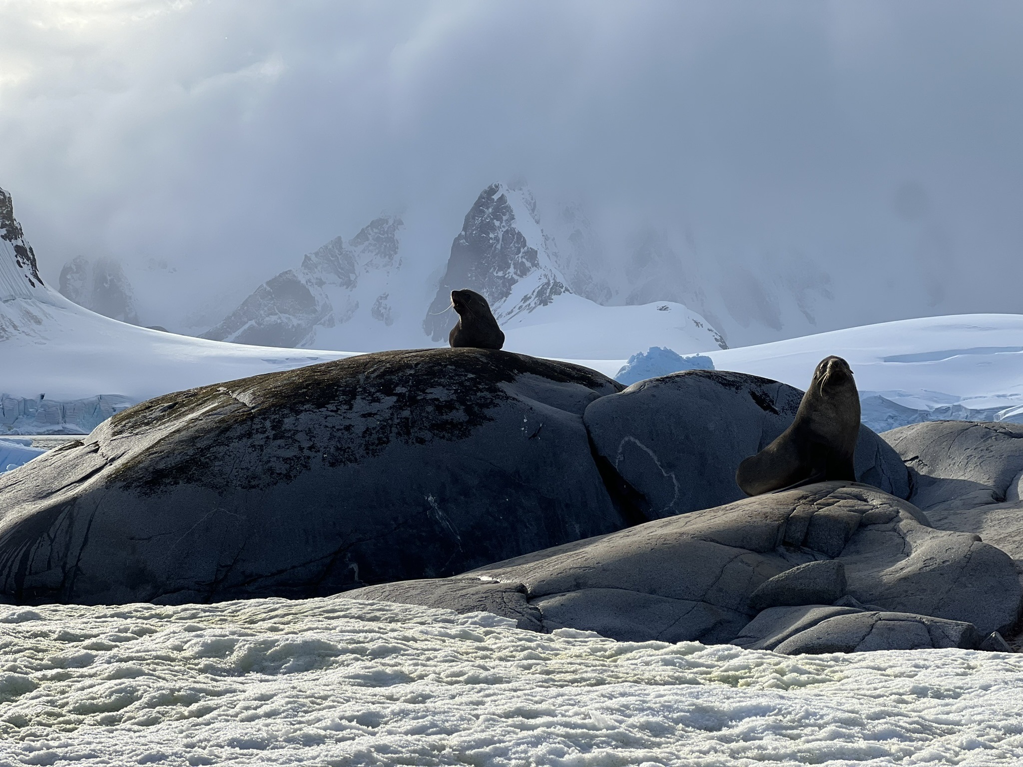
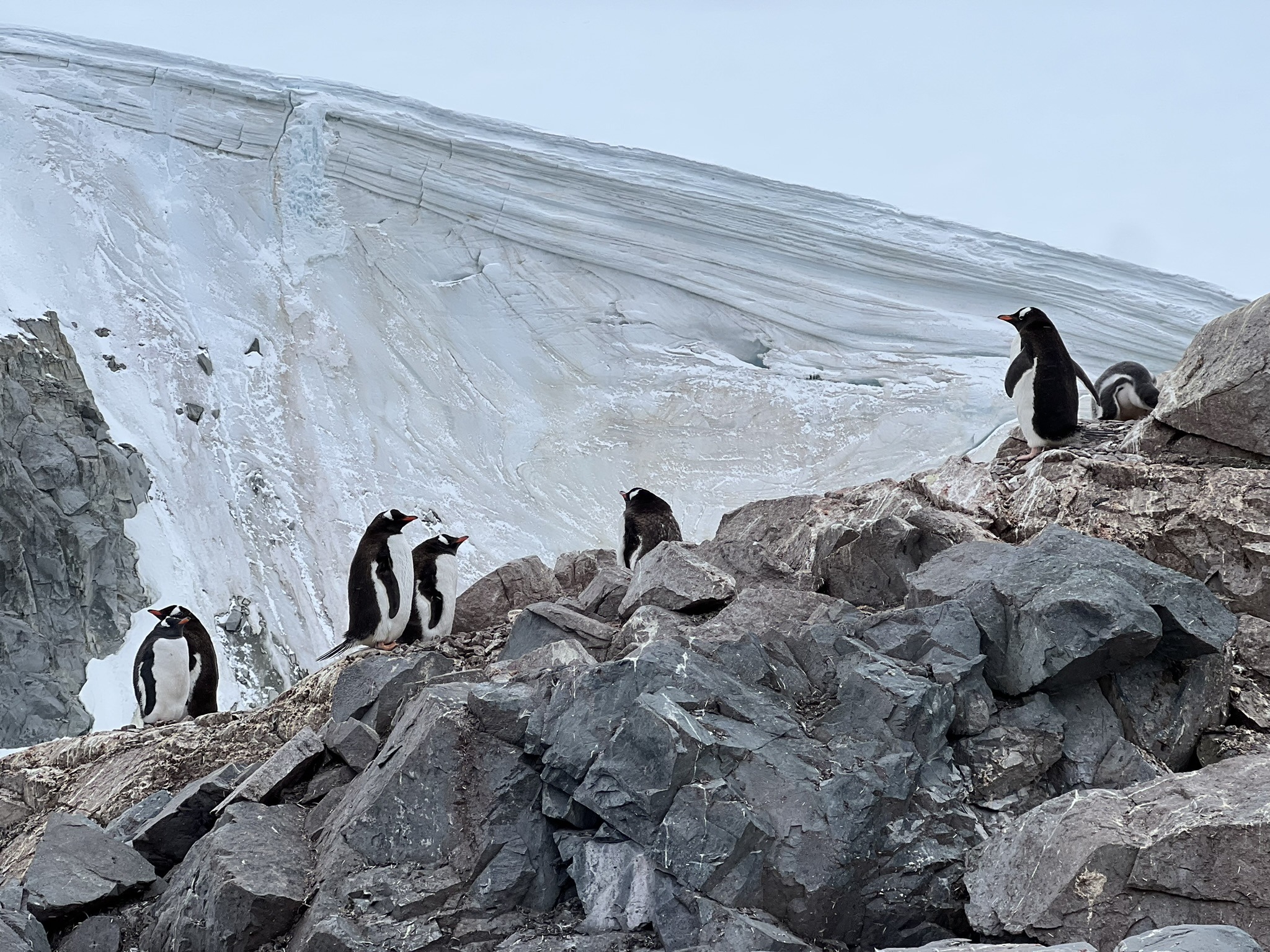
As frozen as my feet felt, the adrenaline kept me warm, too warm in fact, with Roja starting to feel like overkill under the sun. Accompanied by a snowy sheathbill and a couple of fur seals perched on the most ridiculous, postcard-perfect rocks imaginable, with icebergs and snow-covered mountains as their backdrop, I made my way up the fifty-metre hill ahead of us. The summit delivered yet another absurdly good vista, something you start to expect in Antarctica – storm-grey clouds looming over glaciers and mountains, deep-blue sea at their feet, and, of course, a gentoo colony on a bare grey patch surrounded by snow.
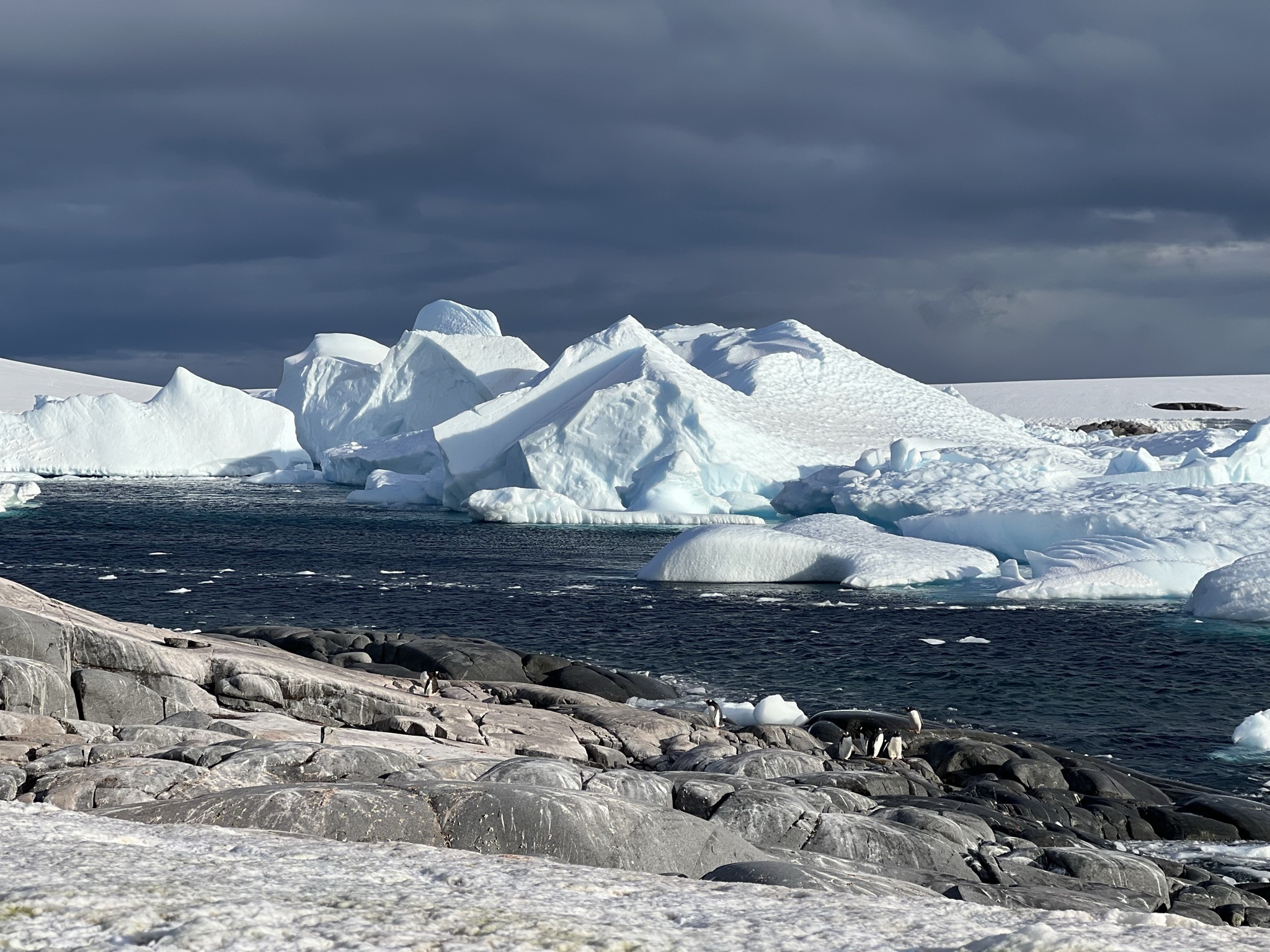
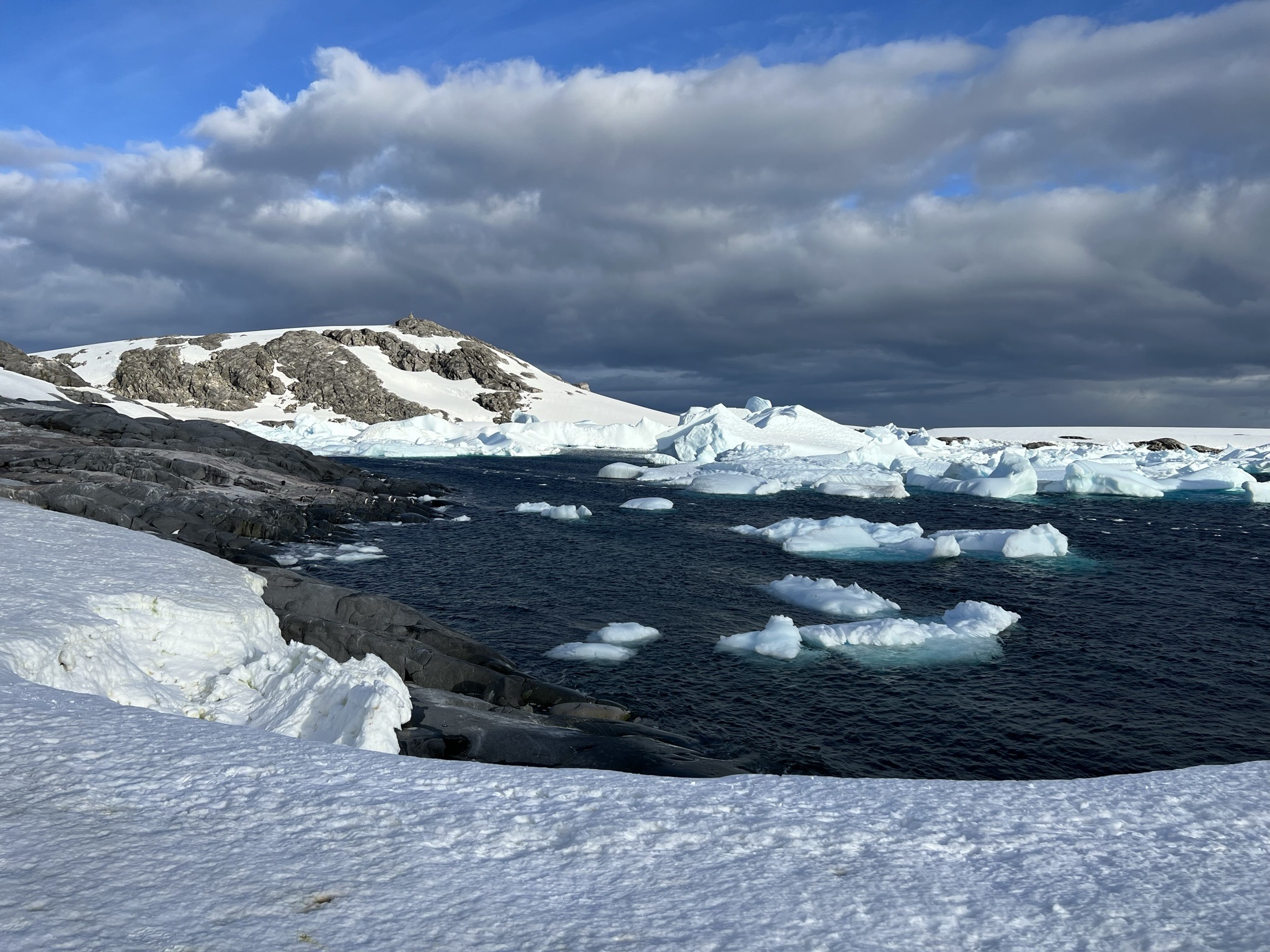
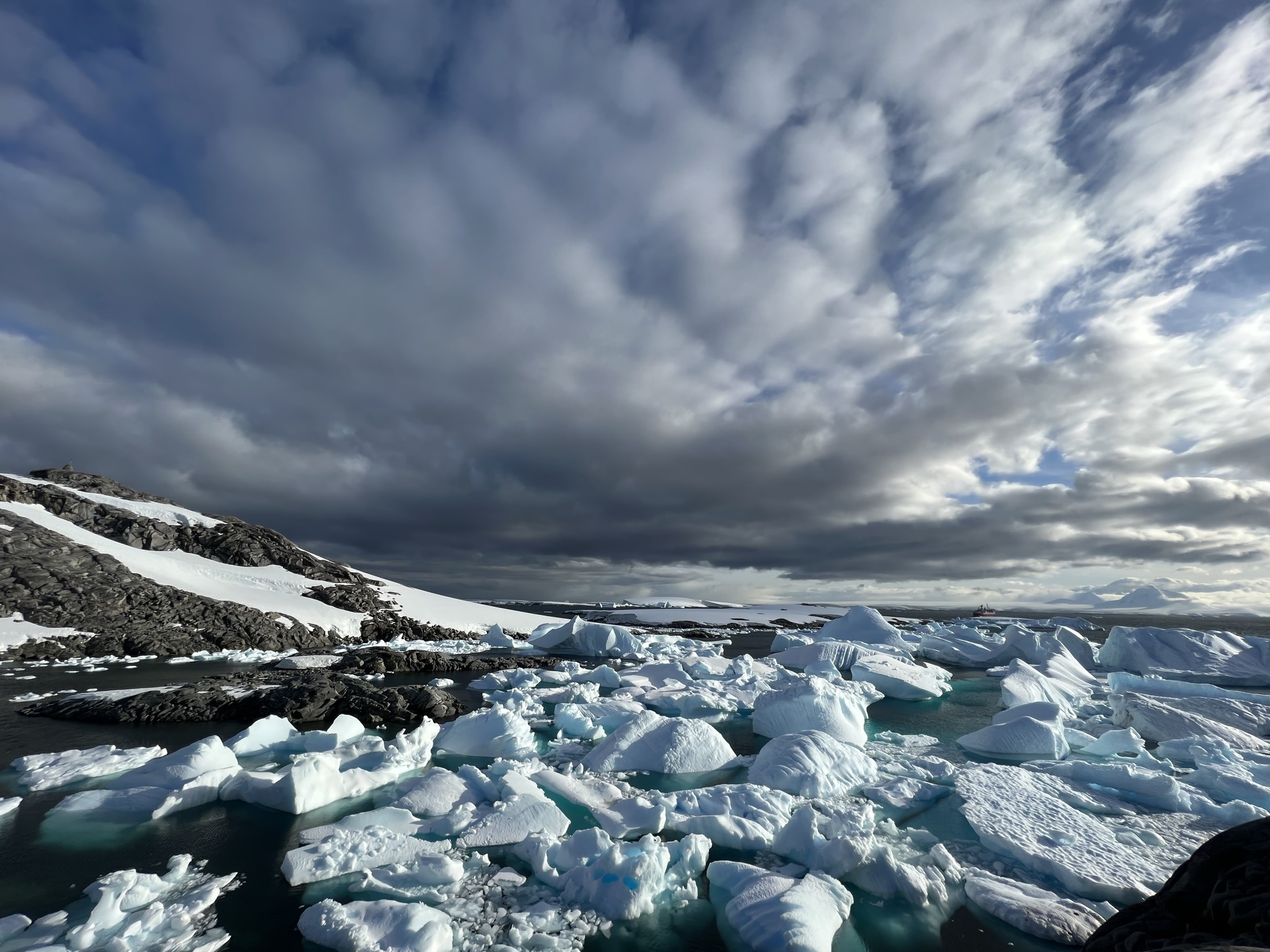
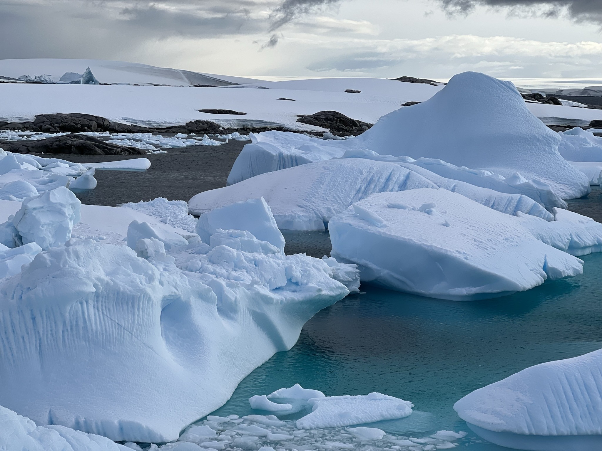
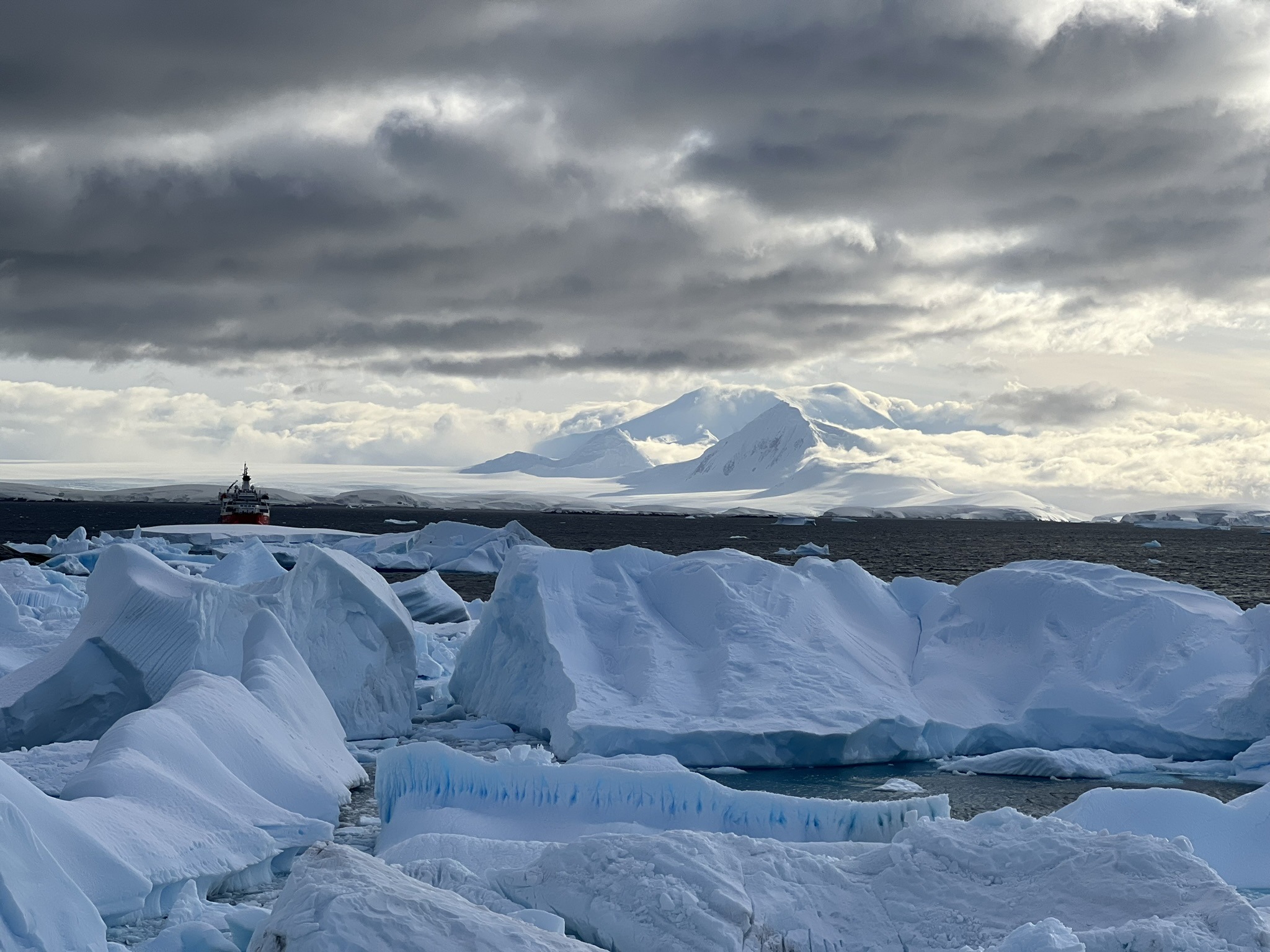
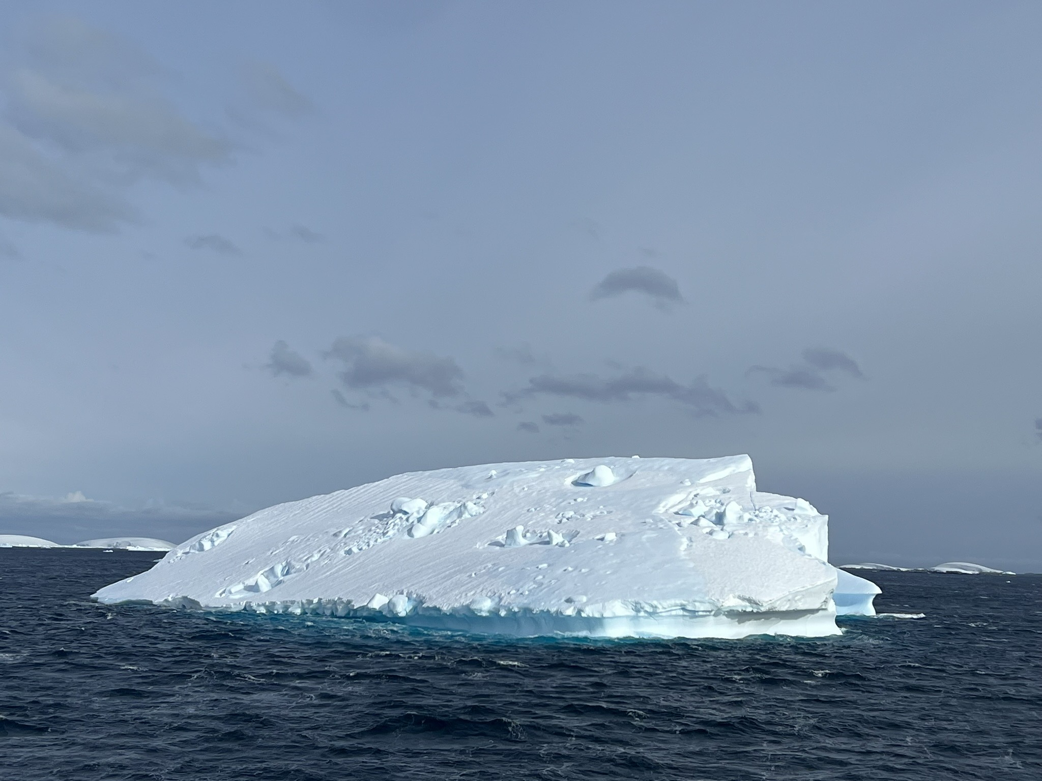
As I made my way up the north-western arm of the island, I was left speechless by the iceberg graveyard Jonathan had told us about – thousands of small pieces of ice, with a few huge ones mixed in, floating in the very bay where Charcot had anchored over a century ago. And thanks to Clara, the view somehow got even better. Turns out, with her polarised sunglasses, the light-blue on the icebergs’ surface and the cyan beneath it look even more intense.
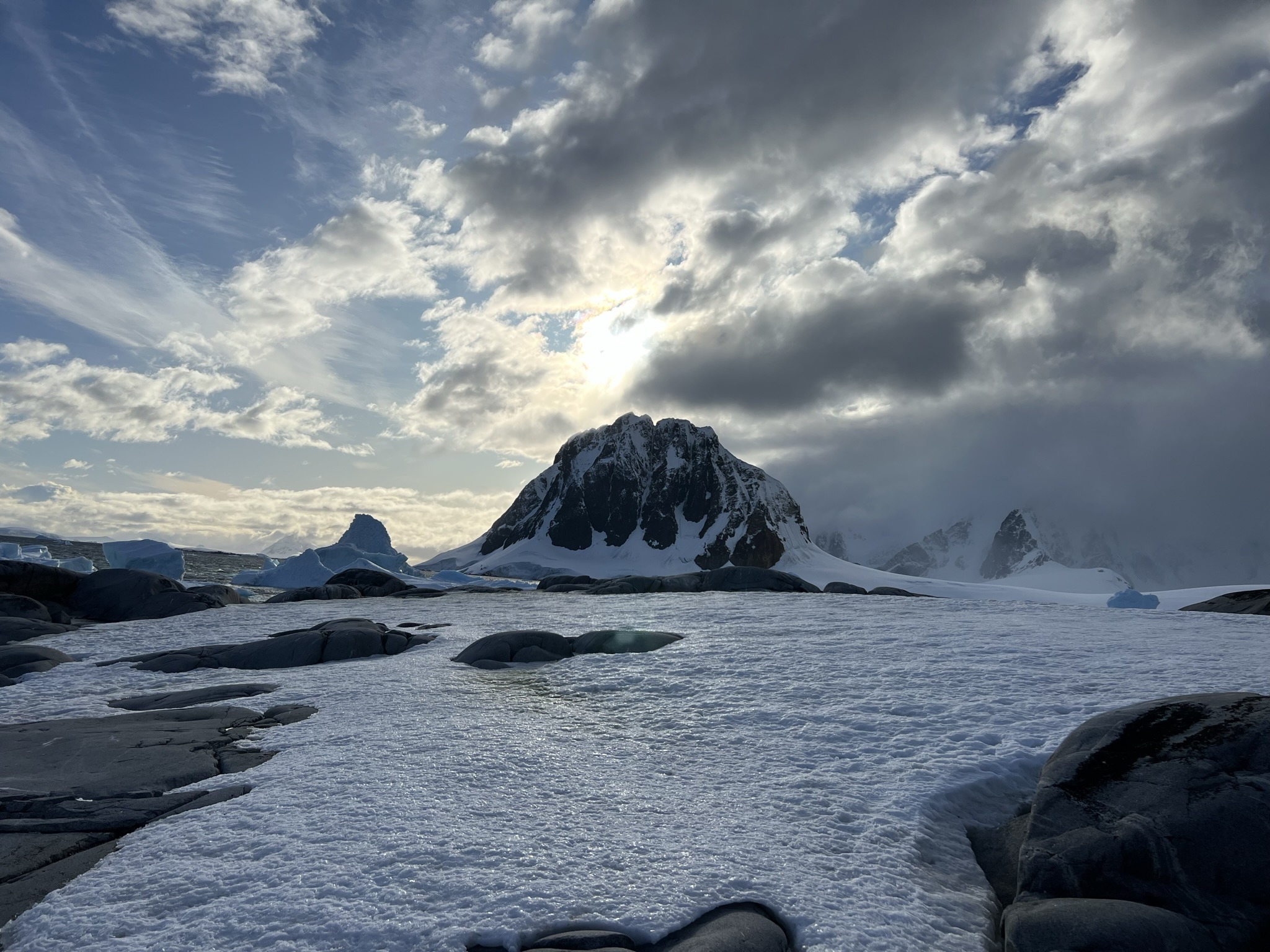
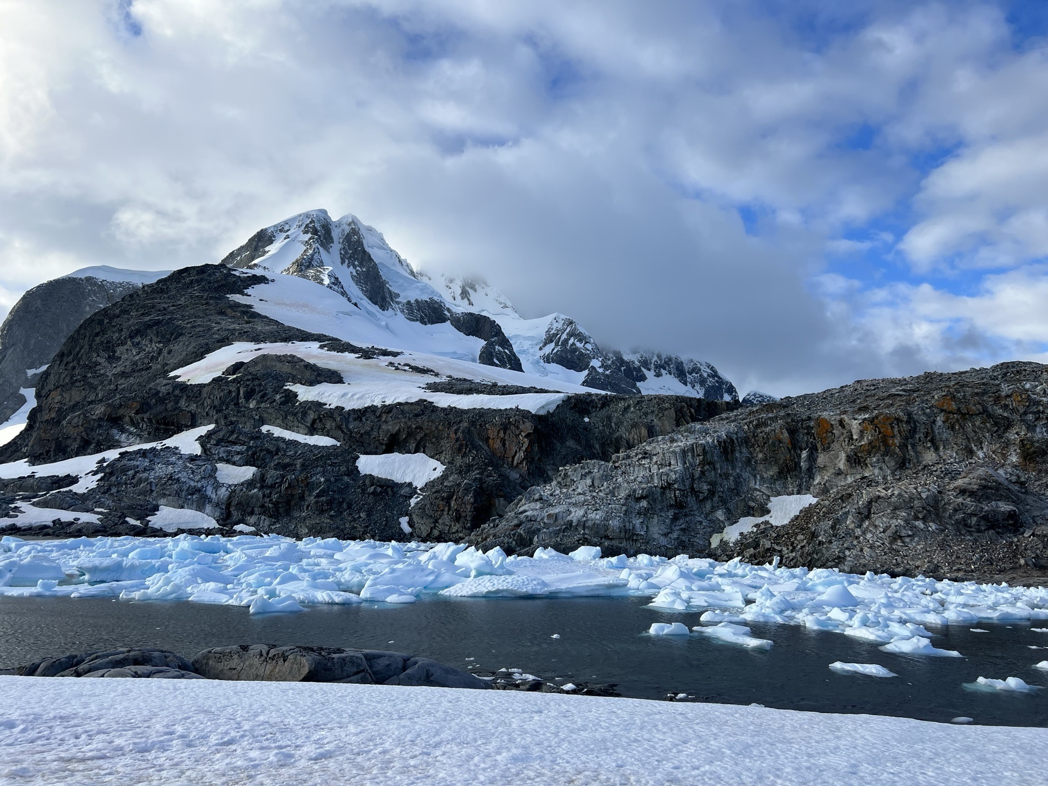
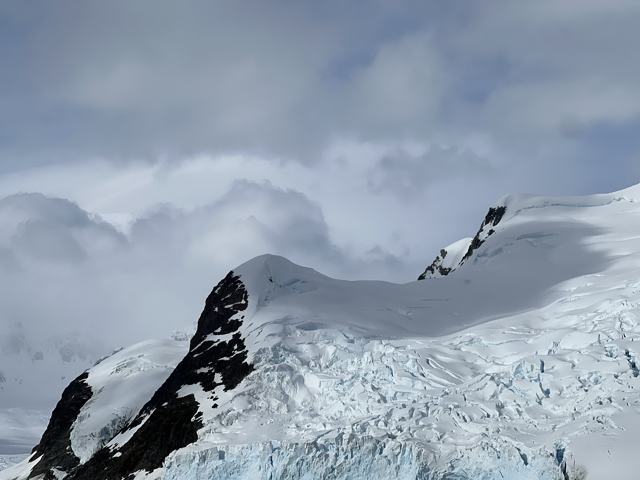
Across the bay, we could see a hill with a structure on top – the famous cairn. A few steps further stood the “observatory”, a simple dry-stone wall with a tiny window that each of us took turns peeking through. As I pressed my face to the opening, my eyes landed first on the icebergs below. Then the whole scene finally sank in. In the distance, Mount Français stood out between the dreary sky and the blue sea, partly veiled by silky white cloud, its slopes sparkling under the sun. Truly surreal. By now we’d seen plenty of white mountains on this continent, but none of them held a candle to this one. And as Jonathan told us, we were incredibly lucky – not only because they hadn’t managed to land at Port Charcot all season, but also because most of the time the summit isn’t even visible.
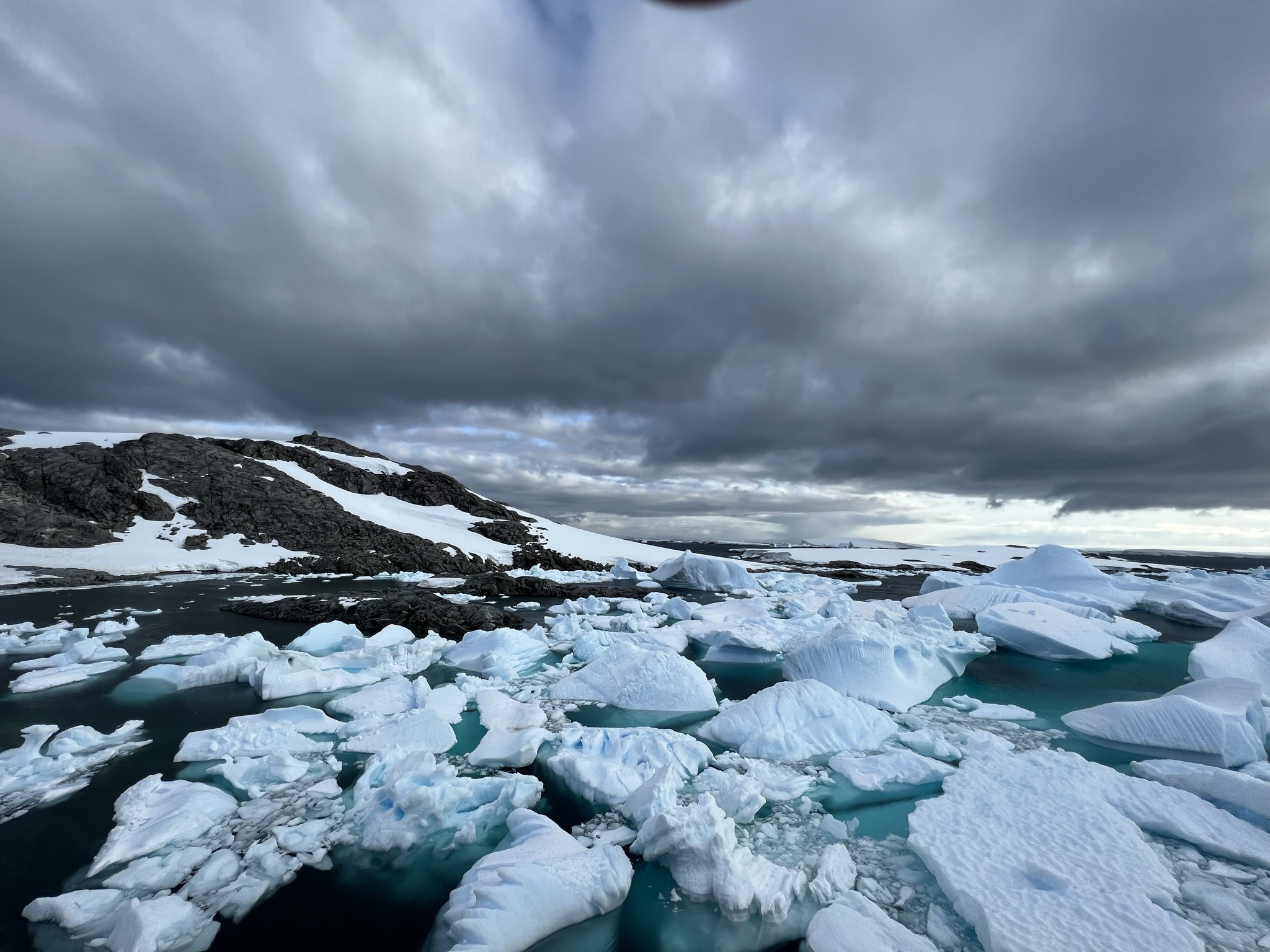
Another ridiculous thing we witnessed while we were there? An iceberg flipping over on itself. Jonathan explained that icebergs flip because they melt unevenly – especially below the waterline – which shifts their centre of gravity and makes them unstable. Since around 90 percent of an iceberg is hidden underwater, changes in shape are not immediately visible. Once the balance between gravity and buoyancy is lost, the iceberg suddenly rolls or flips to reach a more stable position. And seeing it live? Simply insane!
As if that weren’t enough, on the way back to our Little Red Ship we spotted a crabeater seal. Given that they’re the most common seal species in Antarctica, the fact we hadn’t seen one yet had been a cause of dismay for some of us. I, for one, was just thrilled to finally come across one, knowing how random wildlife sightings can be. Wedged between the ridges of a tiny iceberg, a beige shape came into full view as our Zodiac approached. It lay there in full “draw me like one of your French girls” mode, sprawled out and chilling on the ice.
The Legendary Lemaire Channel
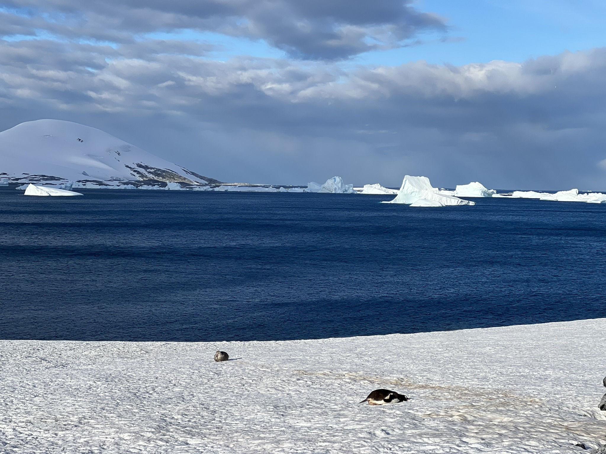
After the morning landing and another heavy lunch, we still had more to look forward to – transiting the famous Lemaire Channel. This eleven-kilometre strait was carved by glaciers and is today often relatively sheltered, with water that can look almost lake-like when conditions are kind, protected by steep land on both sides. It’s also one of the most visited scenic passages on the Antarctic Peninsula.
With the storm system approaching and winds verging on forty knots, we were warned there was a real chance we wouldn’t be able to transit it at all, especially if ice drifted into the channel. But thanks to the captain’s expertise and a fortunate lack of ice, we made it through. And, as a testament to his skill and, well… let’s call it courage, we were apparently the only ship that pushed through and ventured further south, while others stayed nearer Port Charcot. I picked the right horse, huh?
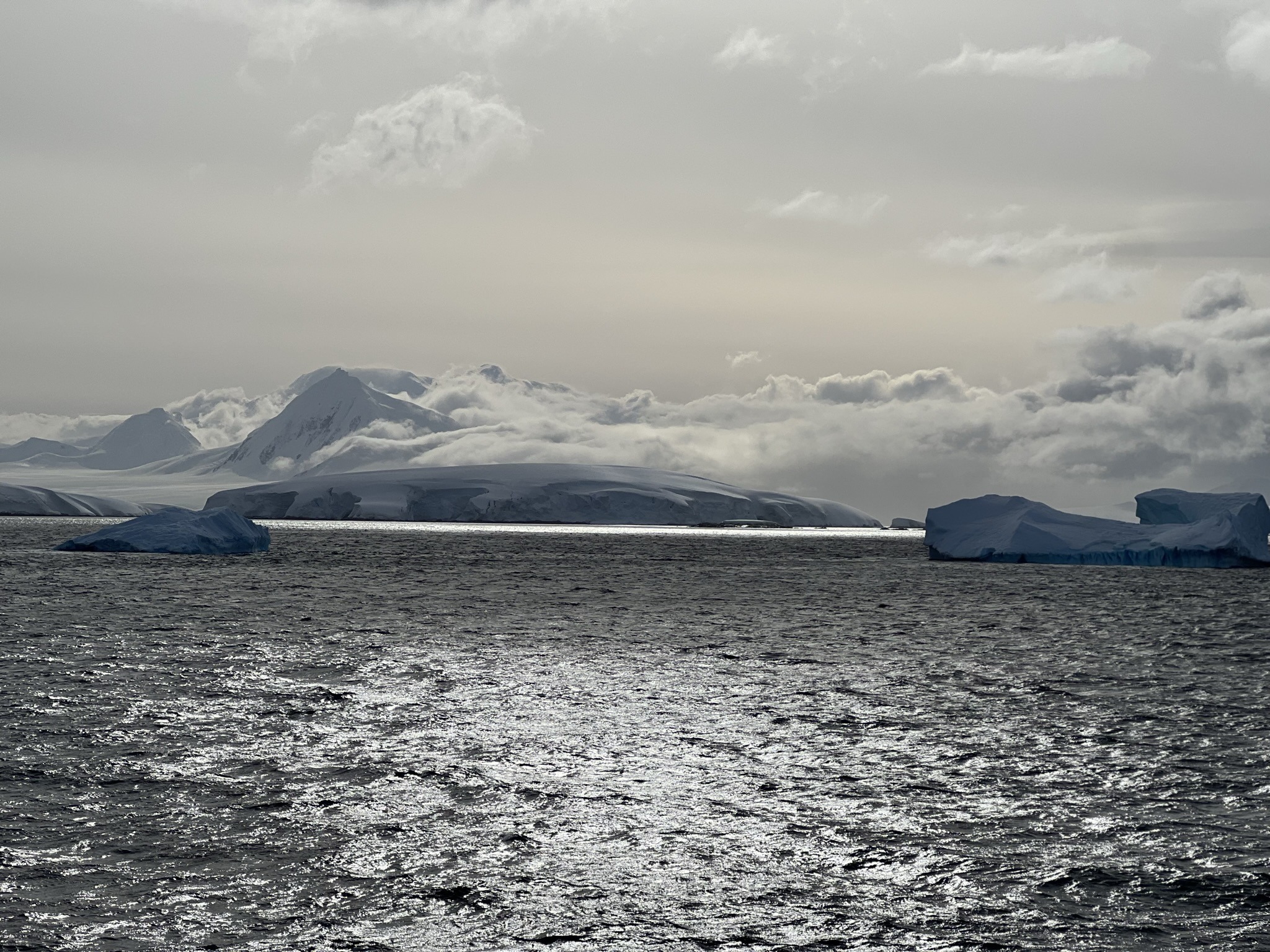
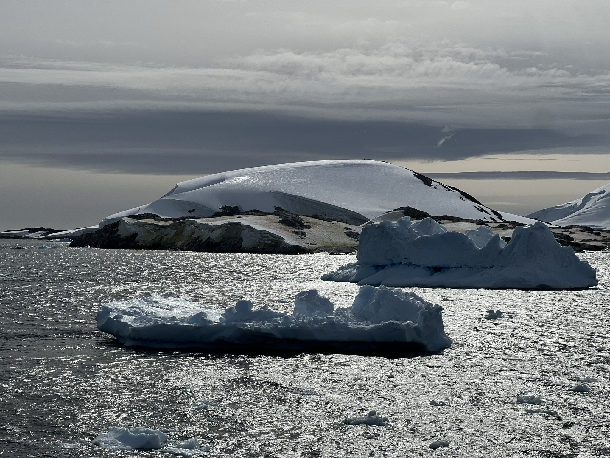
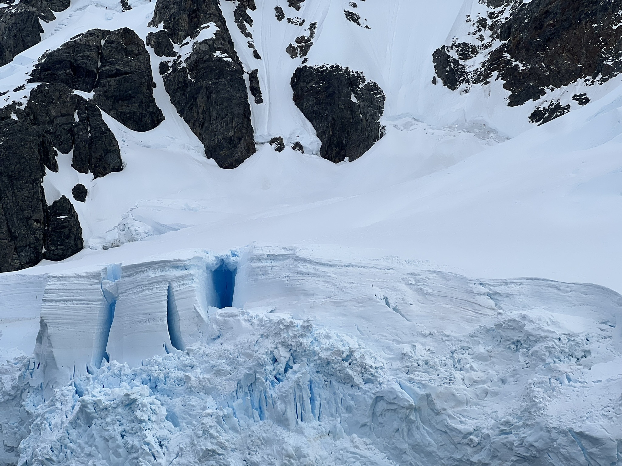
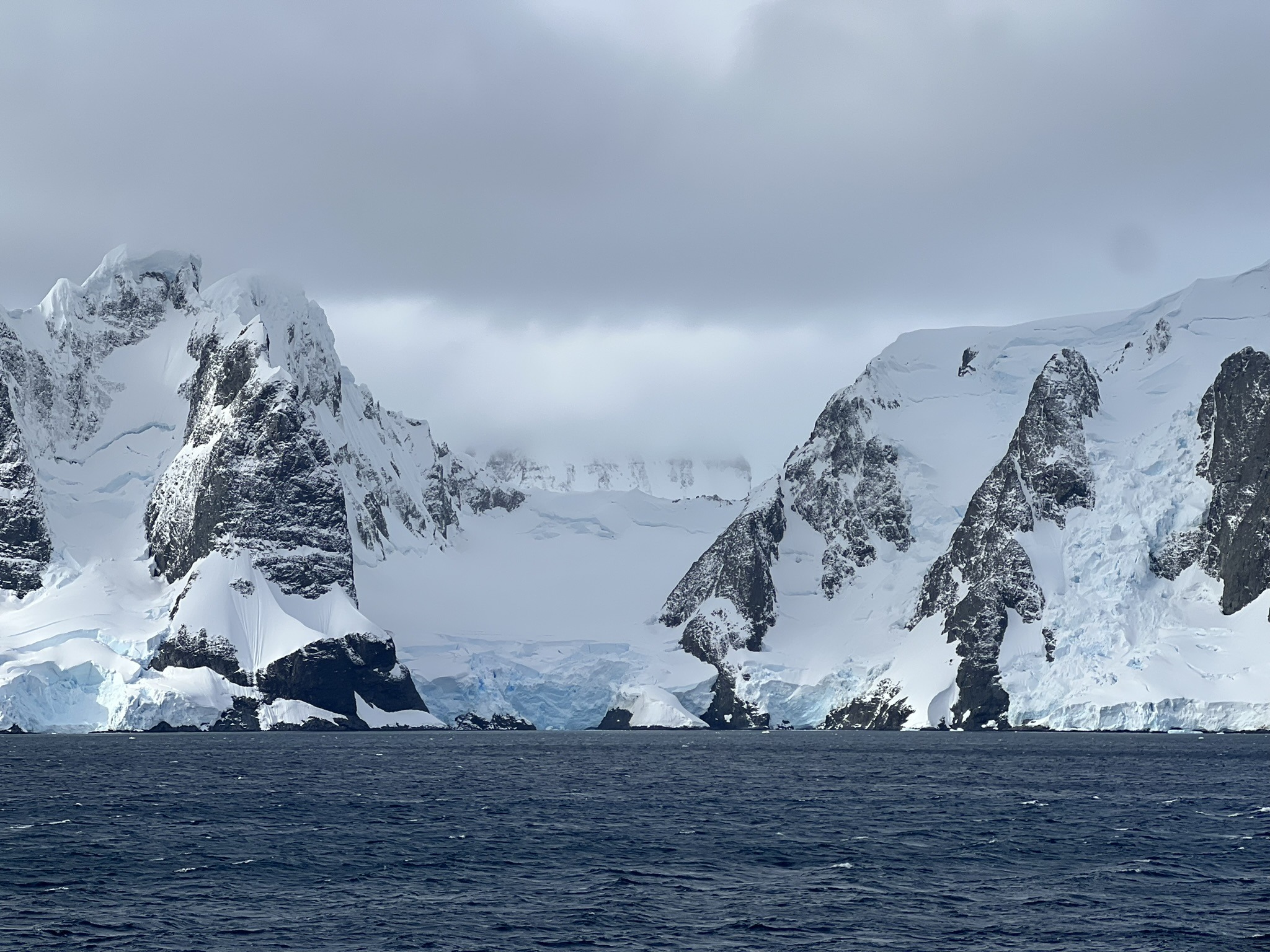
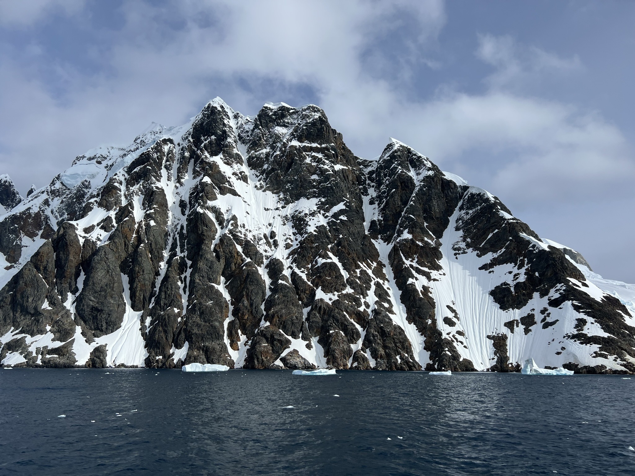
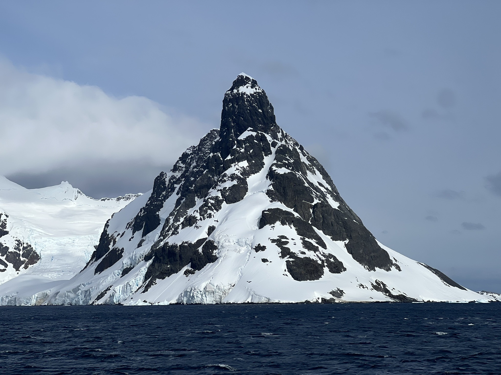
On the bow, everyone stood there with jaws on the floor as we crunched through brash ice, threading between icebergs with only a few metres to spare, all while staring up at glaciers and jagged peaks rising straight from the sea. One in particular looked uncannily like a female breast, now officially dubbed Mont Nipplé. What caught my attention most, though, was a long, narrow chain of ice in the water forming a semi-circle. I couldn’t help wondering whether it was Aokiji’s doing, using his ice-ice powers while casually cycling across the ocean. And let’s not forget the glaciers calving right in front of us.
At times like this, the bow felt less like a ship and more like a photography studio, with everyone queuing up in front of the flag for their photoshoot. I can’t really blame them. Actually, I can’t blame them because I was one of them. I’m pretty sure those were the best views we’d had all trip.
PART II
The Infamous Adélies
Though the trip thus far had been exhausting, the second the next landing would be announced I’d feel renewed and ready for more. And now group Albatross was once again the first called down to the mudroom!
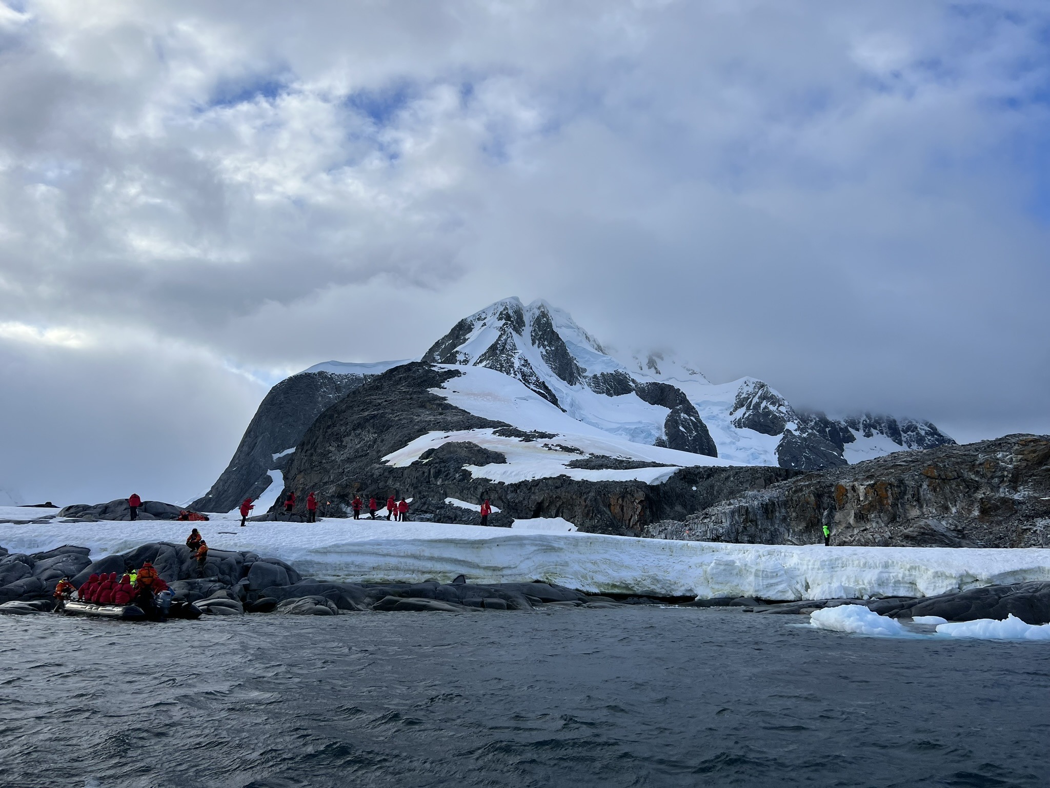
Our next destination was Petermann Island, visible from the southern end of the Lemaire Channel, southwest of Hovgaard Island in the Wilhelm Archipelago. It was discovered during Eduard Dallmann’s expedition in the 1870s and named after August Petermann, a German geographer and polar exploration advocate. It was also visited by Charcot during his second Antarctic expedition (1908-10) aboard the Pourquoi-Pas?, during which he mapped large parts of the Antarctic Peninsula and added a huge amount to scientific knowledge of the region. The charts from Charcot’s expeditions remained influential for years.
Whilst Petermann Island is known for Adélie penguins, they often depart after the breeding season, so I wasn’t banking on seeing many, especially this late in the summer. Being the species I wanted to see most on this trip, I still tried to manifest it. Like when I’d somehow managed to see the whale shark in Utila and the quetzal in Costa Rica.

And, apparently, it worked. On the Zodiac, I heard their name muttered on Matt’s walkie-talkie. The second we landed, I didn’t even bother pretending to admire the scenery. I asked where they’d been spotted and basically sprinted. While everyone else circled the island anti-clockwise, I went in the opposite direction, hunting for the promised bird.
And there they were, in the flesh – Adélies. Not loads of them, mind you, but enough. Among hundreds of gentoos, a few different-looking penguins stood out immediately. Heidi told me to play a game of Where’s Waldo. It took me less than a second. With their black head and back, clean white underparts, and that crisp little white eye-ring, Adélies are unmistakable. They also looked… tidier. More elegant. Less chaotic at the knees. I’d fallen in love with them during Heidi’s presentation, but seeing them right in front of me was something else. I spent at least half an hour staring, as indifferent to the gentoos as the gentoos were to them. Heidi mentioned that penguins don’t generally show strong territorial behaviour towards other species, especially when it’s just a handful mixed in like this.
Exploring Petermann Island
A magnificent white-morph southern giant petrel flew right in front of us and snapped me back to reality. With limited time, I went on to explore the rest of the island.
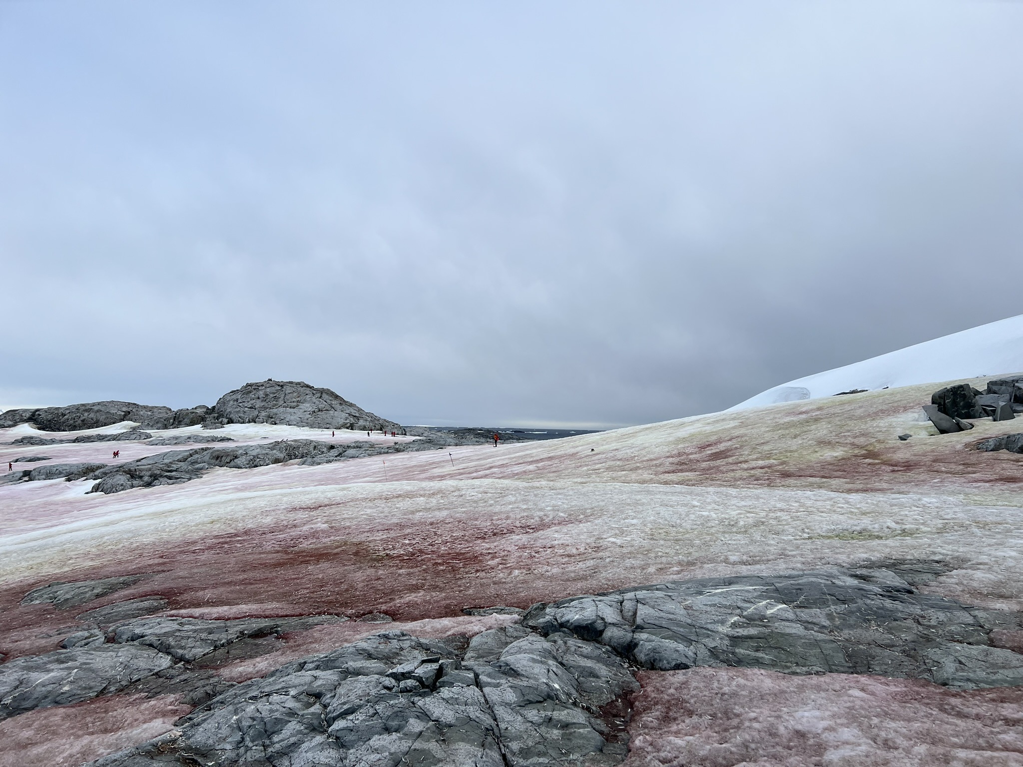
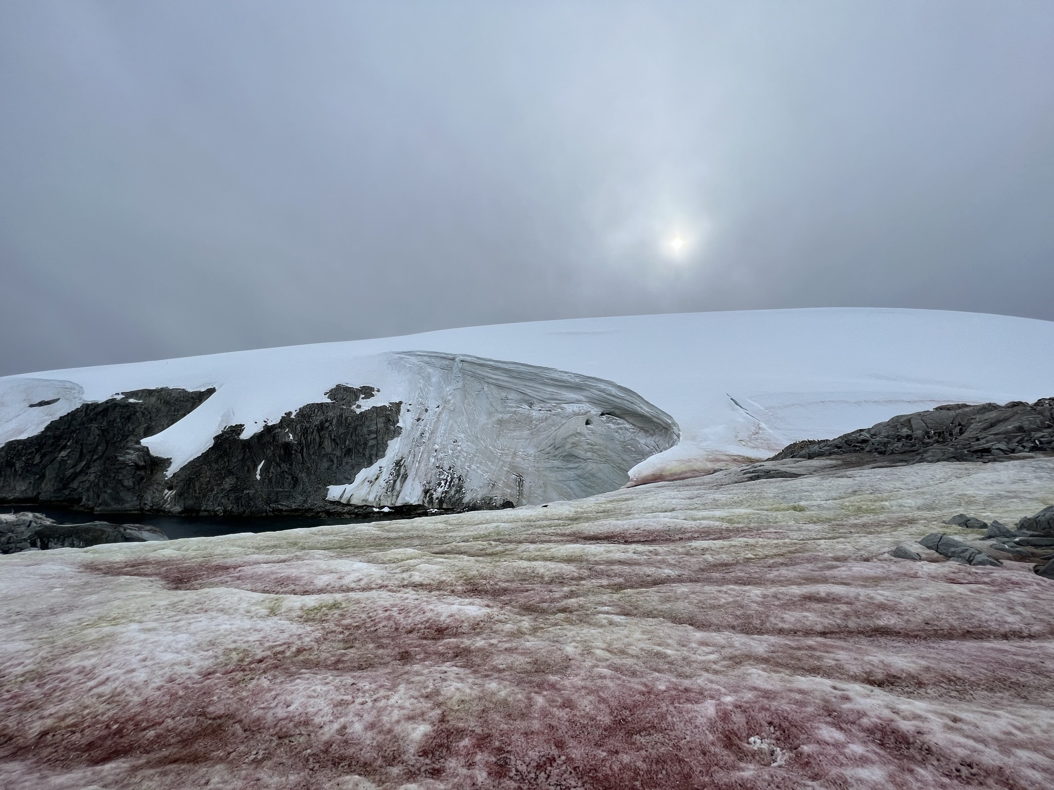
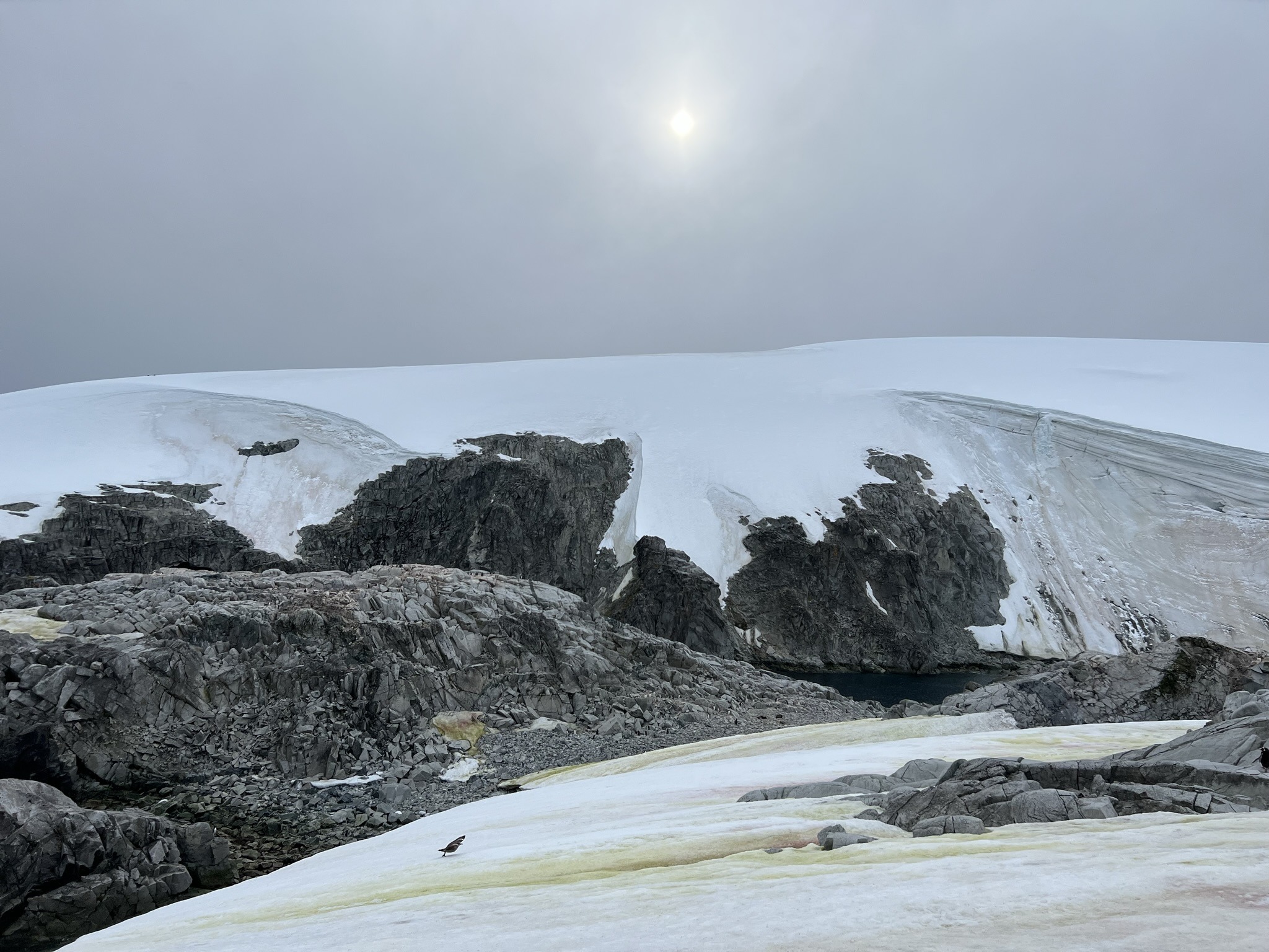
Finally, I could properly appreciate the ridiculous watermelon-red and apple-green snowfields, like something torn straight from a child’s drawing. Many of us assumed it was guano, but John explained it was largely algae – red snow algae can tint snow pink or red, and different blooms can shift the tones. A red hut also stood out near the shore, an old Argentine refuge, now mostly just a landmark.

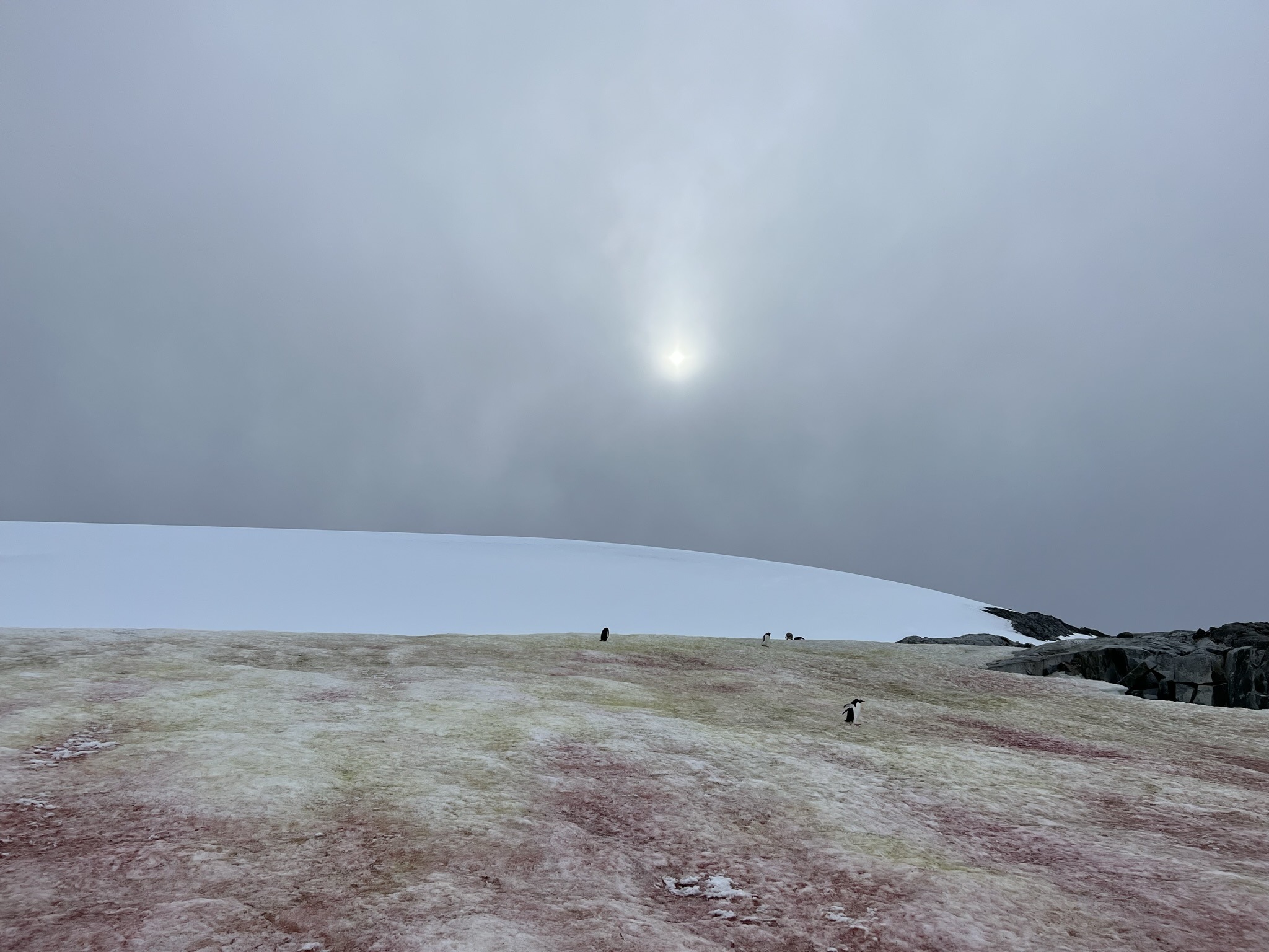
As I wandered between gentoo colonies, some younger and some still moulting, I achieved one of my key Antarctic goals – filming a penguin pooping. I honestly thought I’d never catch it live after so many close encounters. But I did. I have proof. Penguins poop! And don’t be fooled, I’m not the only one fascinated by that pinkish-white projectile that shoots from their cloaca with zero warning. There’s even scientific research on penguin poop and how it can reveal colony size and nutrient impacts, and yes, there’s a scientific paper on the skittibility of penguin poop. Science is beautiful.
Apart from pooping, I witnessed other shenanigans – penguins flapping uncontrollably until they lost balance and face-planted into the snow, and one that kept itself busy tobogganing down a penguin highway like it was training for the Winter Olympics. Did I mention how much I love penguins?
But it wasn’t just penguins. From soaring blue-eyed shags to a growling fur seal that charged at most of us despite the distance rule, we were kept in awe throughout. Also one final surprise – a Weddell seal in all its glory. A grey, round blob of fat with the cutest cat-like face imaginable, lounging on its side and soaking up the attention like it was being paid.

After completing the loop, I had to go back to the Adélies for one last look. That’s when the weather shifted in a split-second – the dark clouds that had been looming suddenly charged towards us. Not wanting to overwinter here like Charcot, I rushed back to the Zodiac, just in time to get a quick cruise around the island. The highlight was spotting “PP” etched into the rock, initials for Charcot’s Pourquoi-Pas?. Shortly after, we had to evacuate, with winds reportedly hitting around seventy knots. They weren’t kidding about katabatic winds, were they?
A Strom is Brewin'
You’d think that would’ve been enough for one day. You’d be wrong. During the evening briefing, Jonathan told us that because the storm was intensifying, we’d be heading back north a few hours earlier than planned to avoid the worst of it when we later crossed the Drake. Sensible, sure – but what were the odds a landing would get cancelled? Pretty high, I assumed. And that thought genuinely terrified me.
After dinner, the evening activity was a lecture by Jonathan, a shark scientist and underwater photographer. He spoke about the largest fish in the sea – the whale shark. Having encountered a few back in Utila, my interest in these gentle giants had only grown. He mentioned featuring in BBC’s Blue Planet II, and described research techniques used to study whale sharks, including tagging and field observation, as well as filming methods in challenging conditions.
After that, it was movie and popcorn time. They played Galapagos: Secrets of the Ocean Giants, a documentary following scientists studying whale sharks in the Galapagos, trying to understand their movements and life cycles, with the key message being that without understanding breeding and migration, we can’t properly protect them.
Day five:
-
-
- Morning:
-
-
-
-
-
- Weather:
-
- Sunny and cloudy
- Wind: NE 34-40kts
- Wave: NE 1m
- Temperature: 3°C
-
- Weather:
-
-
-
-
-
-
-
- Position: 65°4’S 64°0’W
-
-
-
-
-
- Afternoon:
-
-
-
-
-
- Weather:
-
- Overcast
- Wind: NE 34-40kts
- Wave: NE 1m
- Temperature: 3°C
-
- Weather:
-
-
-
-
-
-
-
- Position: 65°10’S 64°10’W
- Position: 65°10’S 64°10’W
-
-
-
-
-
- Animals seen:
-
-
-
-
-
-
- Gentoo penguins
- Adélie penguins
- Southern fulmar
- Southern giant petrel
- Wilson’s storm petrel
- Brown skua
- Antarctic blue-eyed shag
- Antarctic tern
- Arctic tern*
- Brown-hooded gull
- Pale-faced sheathbill
- Antarctic fur seal
- Crabeater seal
- Weddell seal
- Humpback whale
- Antarctic minke whale*
-
-
-
-
* Ones I didn’t get to see myself.