Having to peel myself away from Roy and get out of the most comfortable bed in existence proved to be one of the hardest things I’ve ever done. Luckily enough, we had a full day of activities and adventures to look forward to.
After having breakfast and bidding Kay and Darcy adios, Roy and I rented a car and started making our way toward San Ignacio – my final destination in Belize. Finally, it felt like I’d be the one showing Roy around, given that he had never been to some of the places I had set my mind on visiting. Plus, the locals here spoke Spanish – giving me a good excuse to brush up on everything I’d learned so far while impressing Roy in one fell swoop!
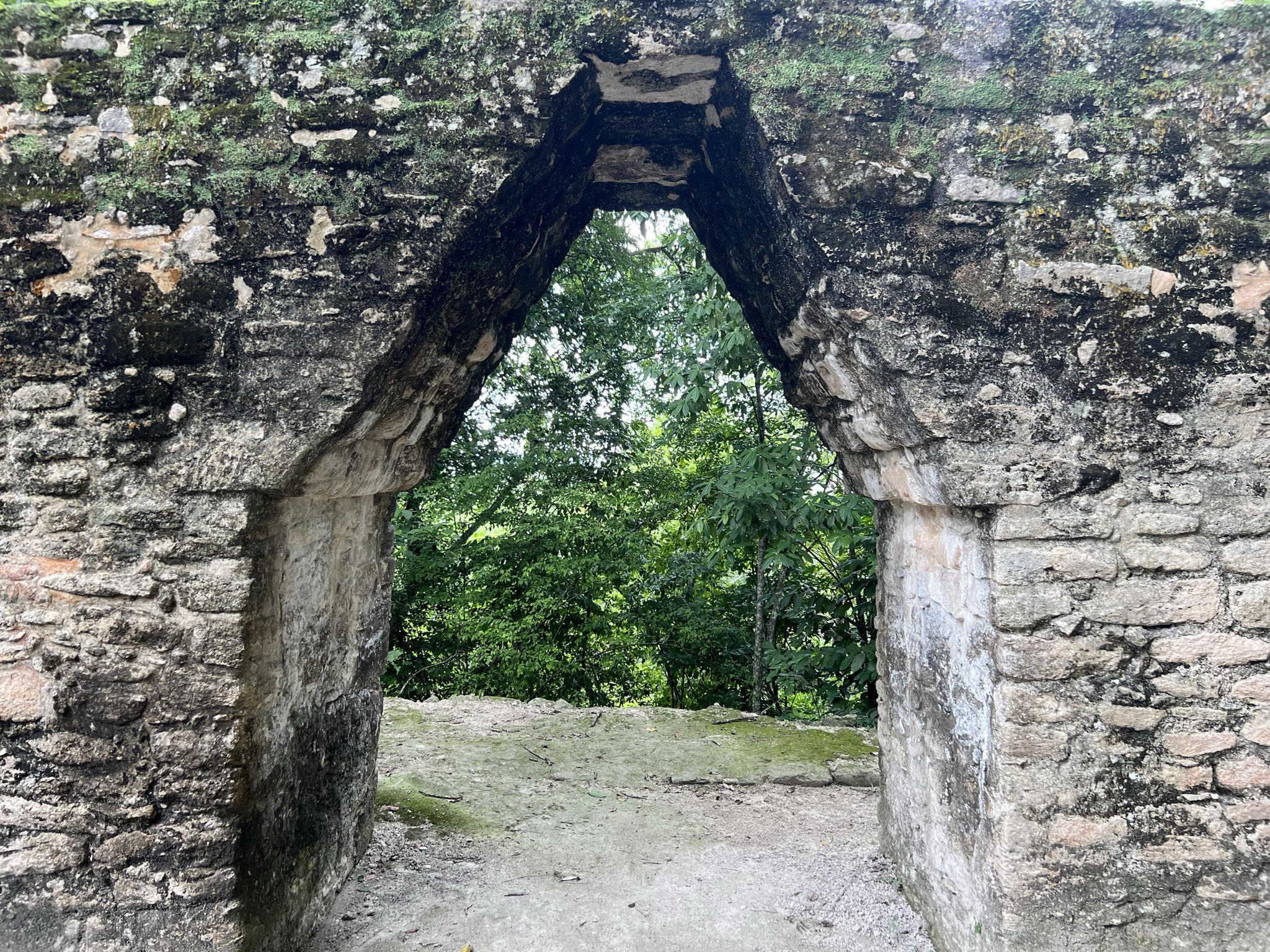
Our first stop was one I had been looking forward to immensely – the ruins of Xunantunich. Ahh, ruins – I had missed them so much! Back in Mexico, I had been visiting all kinds of ruins almost daily, satisfying my Tomb Raider cravings and keeping my inner historian entertained throughout. Ever since I’d arrived in Belize, the closest I had gotten to ruins were the dilapidated structures in the Marco Gonzales Archaeological Reserve on Ambergris Caye. But finally… finally I’d be quenching my thirst for archaeology and history once again!
Xunantunich
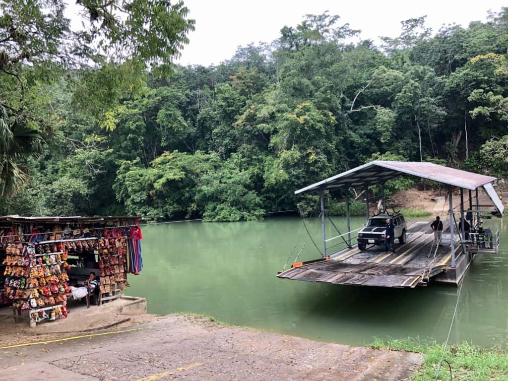
Something quite odd and quirky about the site of Xunantunich is that to access it, you have to cross the Mopan River on a hand-cranked ferry.
At my insistence – and much against Roy’s wishes – we hired a guide to take us around the site. I’d roamed ruins on my own before, and while that allows you the freedom to peruse every single rock and remnant, I felt it quite pointless not knowing where they came from or what their purpose was. However, I gotta give it to Roy – hiring this particular guide might not have been the brightest move. Carlos, a seventy-something-year-old gentleman who spoke fluent Mayan and Spanish, had been working at the site since the sixties. You’d think that’d make him the perfect candidate to give us the best possible tour – only he was anything but.
He’d tell us everything he thought was necessary (the most basic stuff we already knew), kept on circling around every single question of ours (which, believe it or not, weren’t about his dogs), and – most frustrating of all – had to stop and catch his breath every ten metres or so (heart failure?). Don’t wanna sound like an ageist, but perhaps it might be time for retirement.
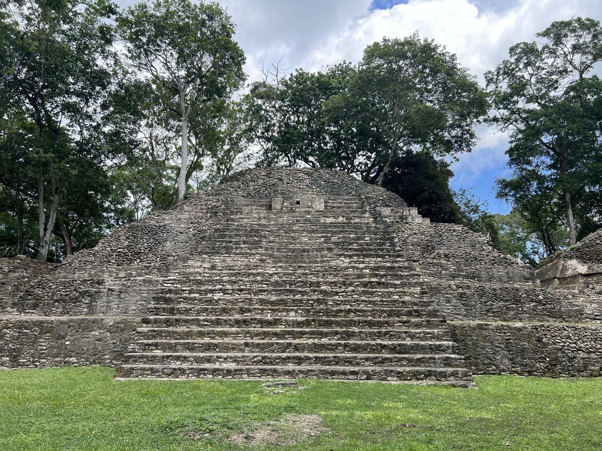
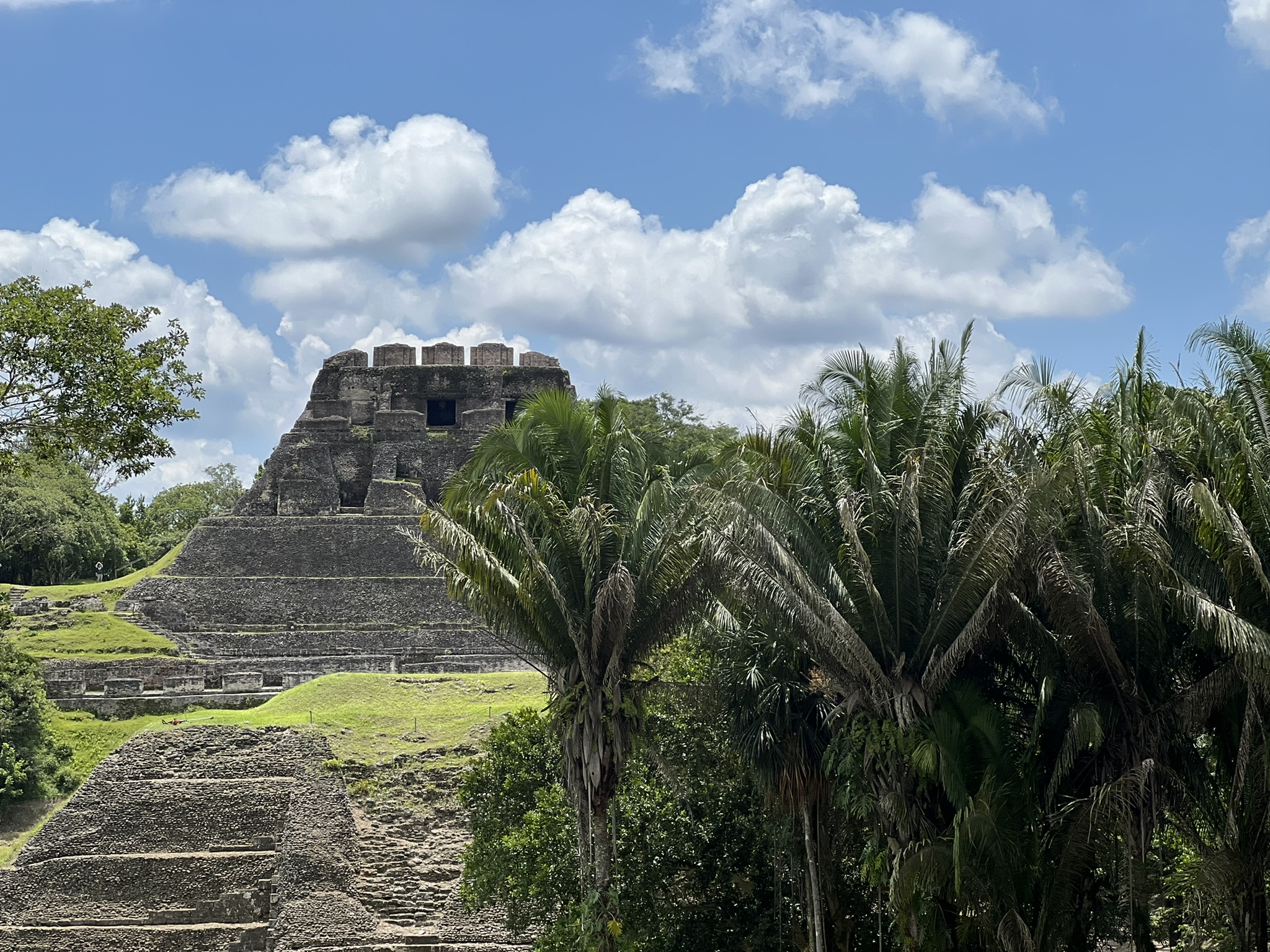
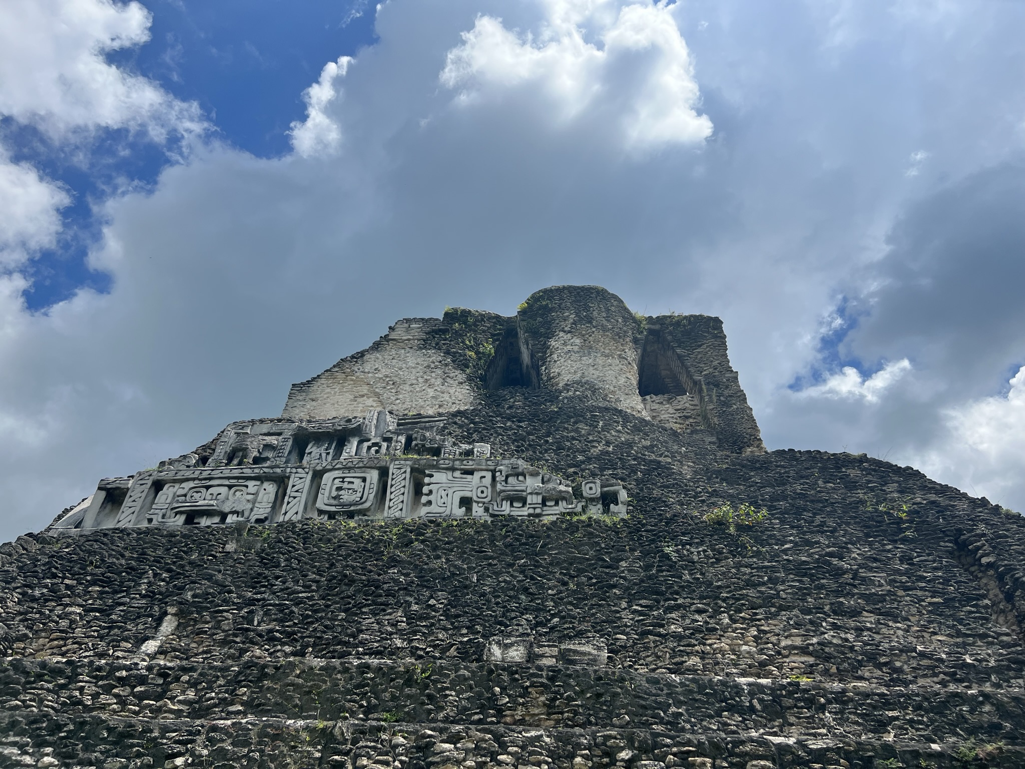
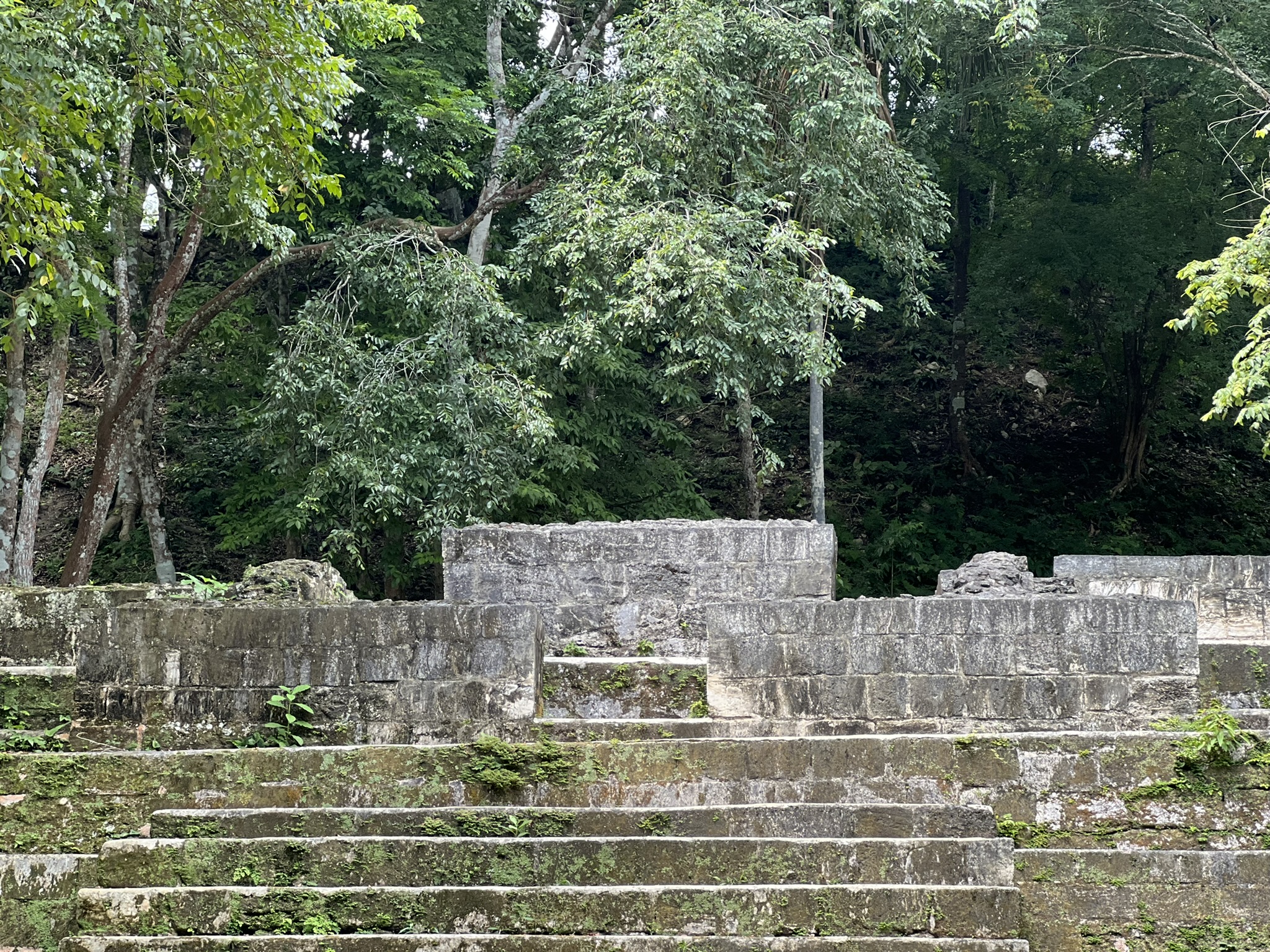
Guide or no guide, we still got to enjoy the ruins. Xunantunich – the information board told us – means “Maiden of the Rock” and was built during the Classic Period on a hill overlooking the Mopan River to control trade along the river, housing some 10,000 to 20,000 inhabitants at its peak. From the stelae found at the site, we now know that the Maya living here were in constant struggle with the great city-states of Tikal and Calakmul.
https://www.researchgate.net/
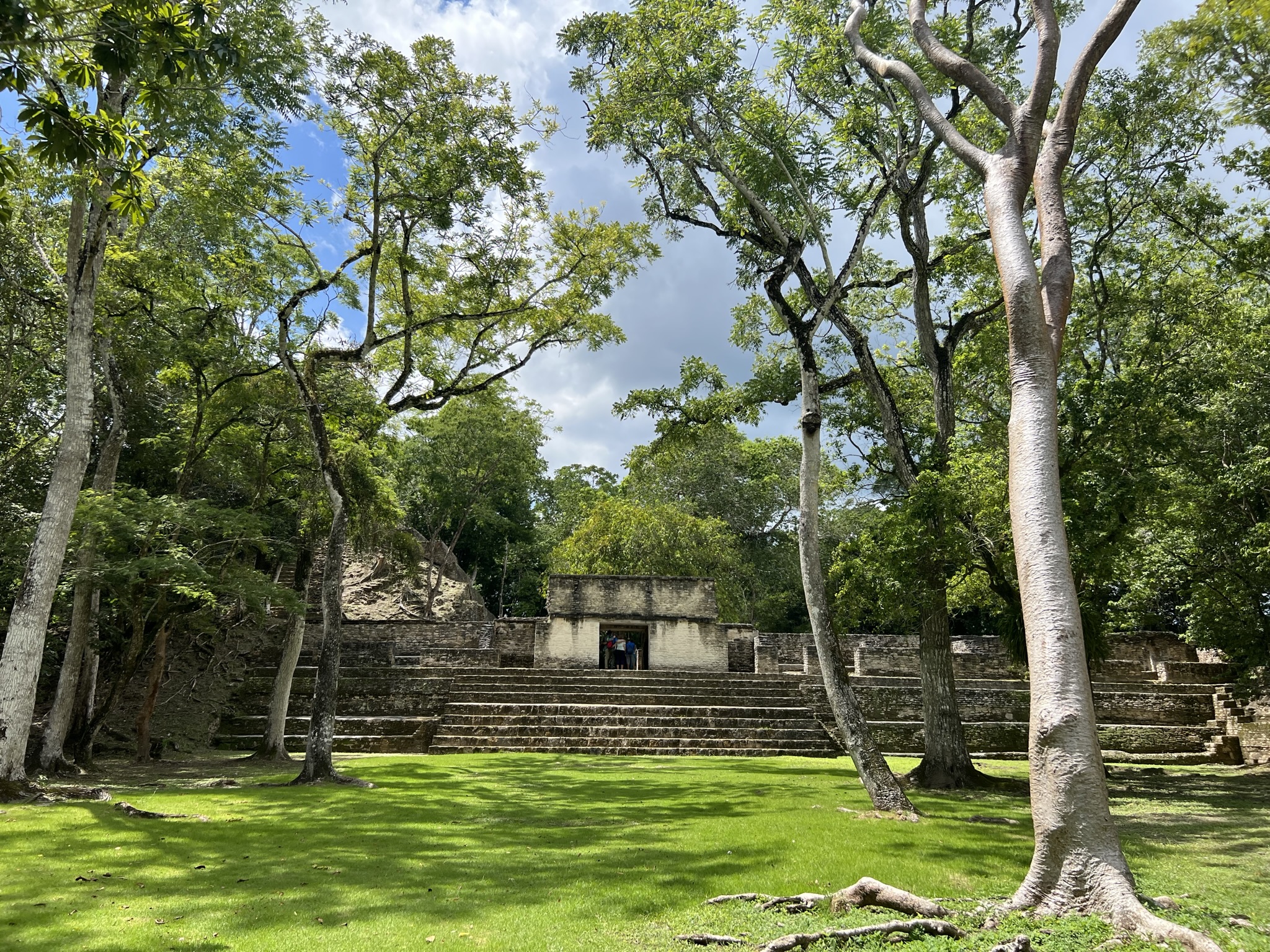
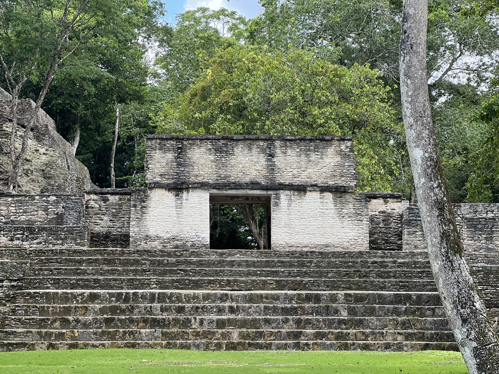
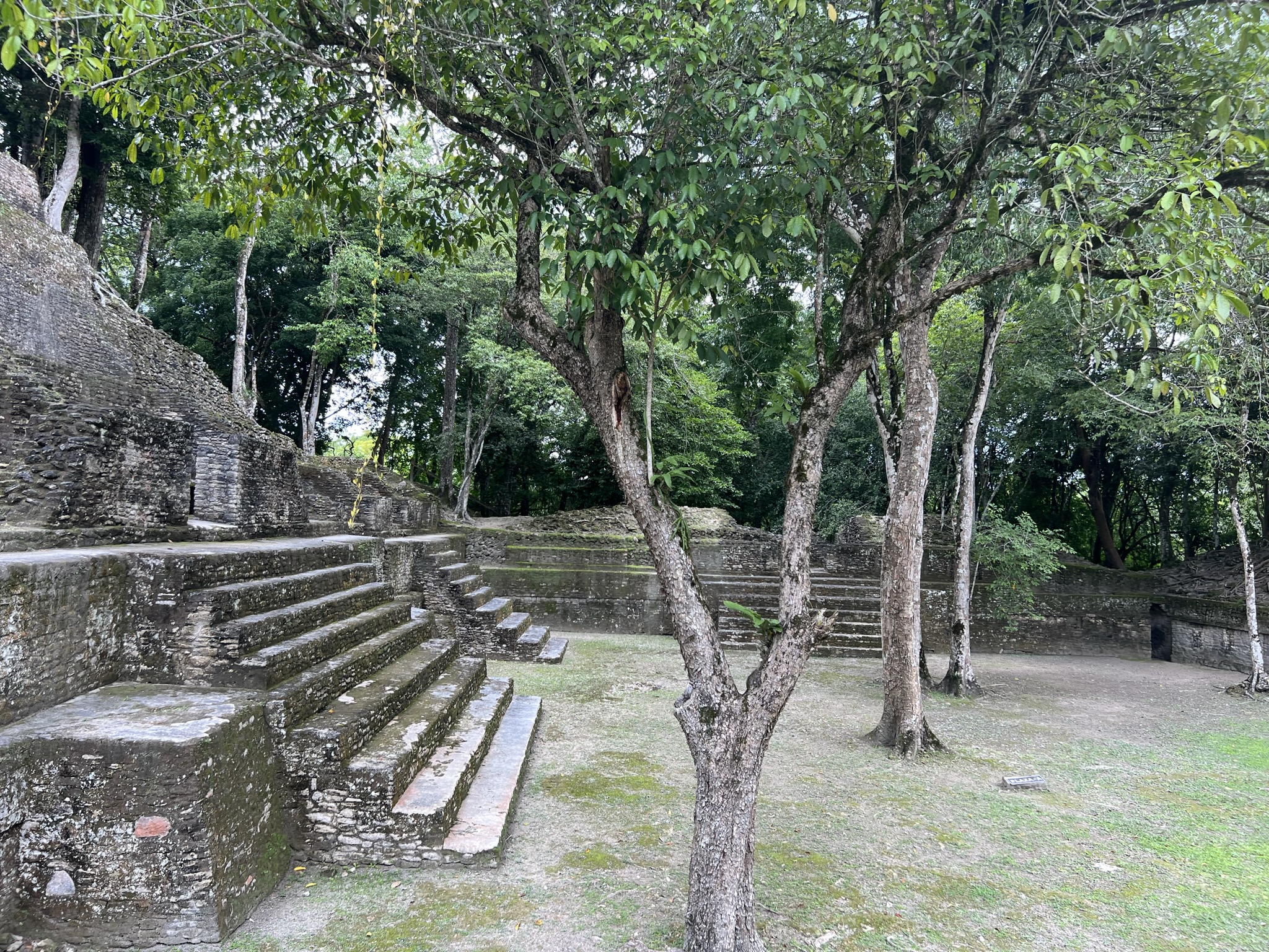
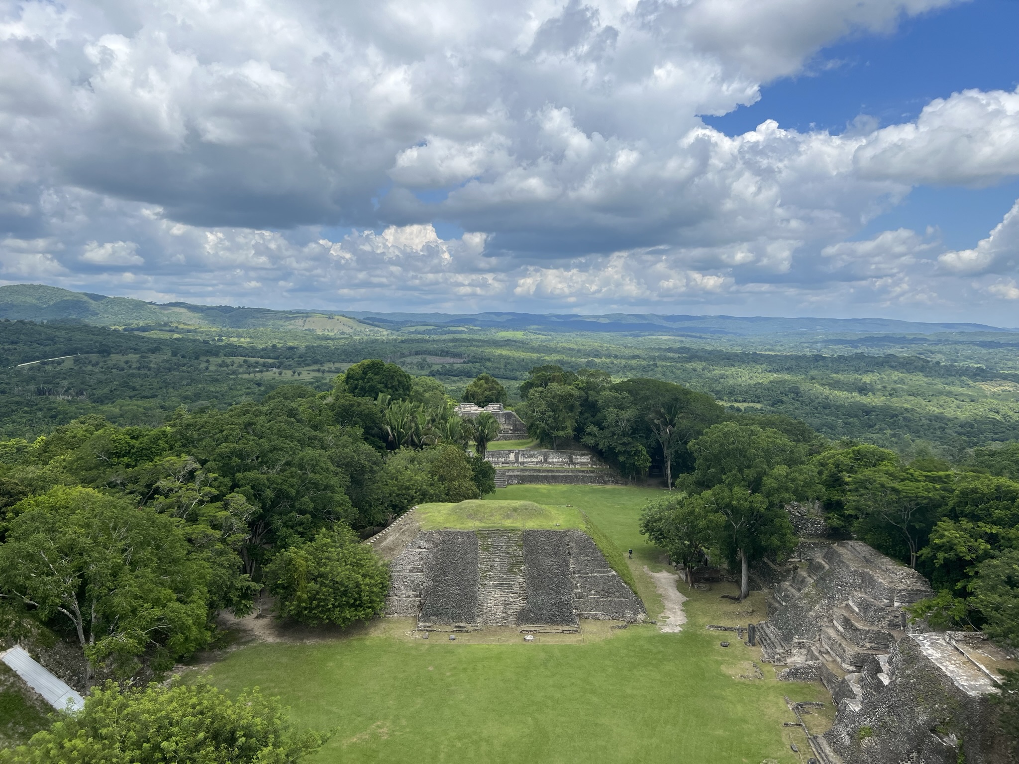
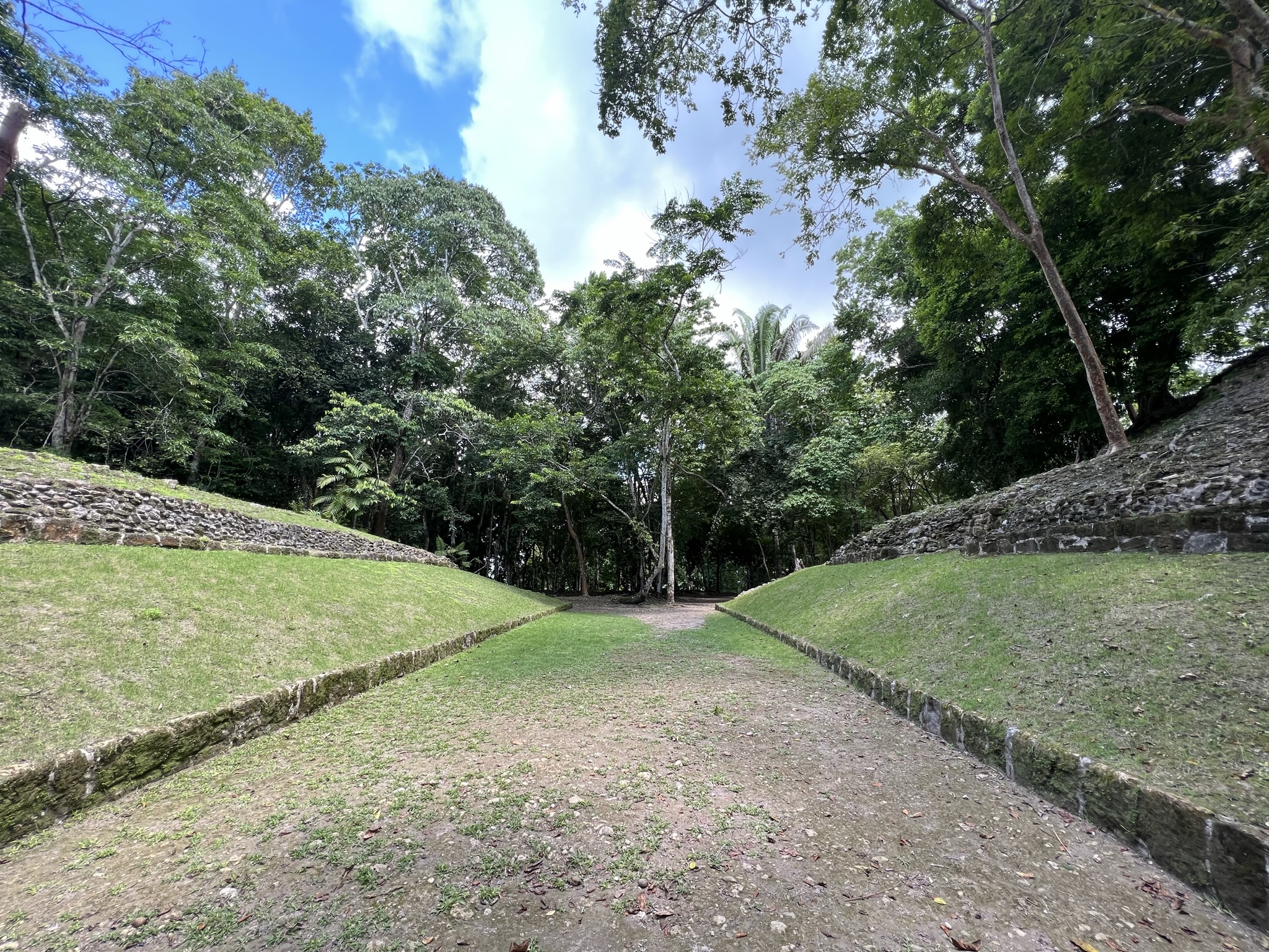
After walking up a short hill which nearly left Carlos dead, we reached the A-I Plaza – a square that is surrounded by the most important structures here in Xunantunich, all nestled within the verdant tropical rainforest and aligned to the directions of the universe.
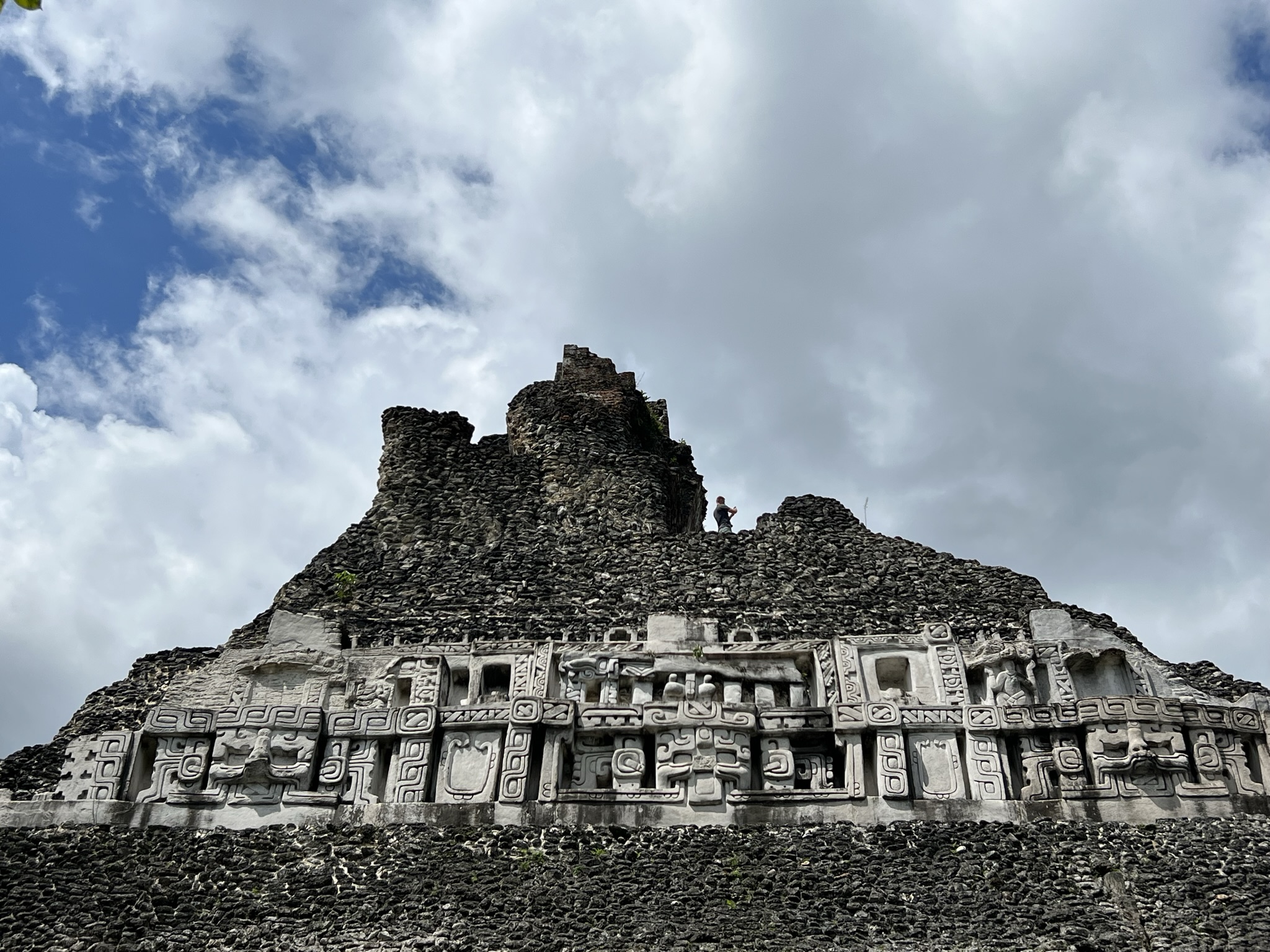
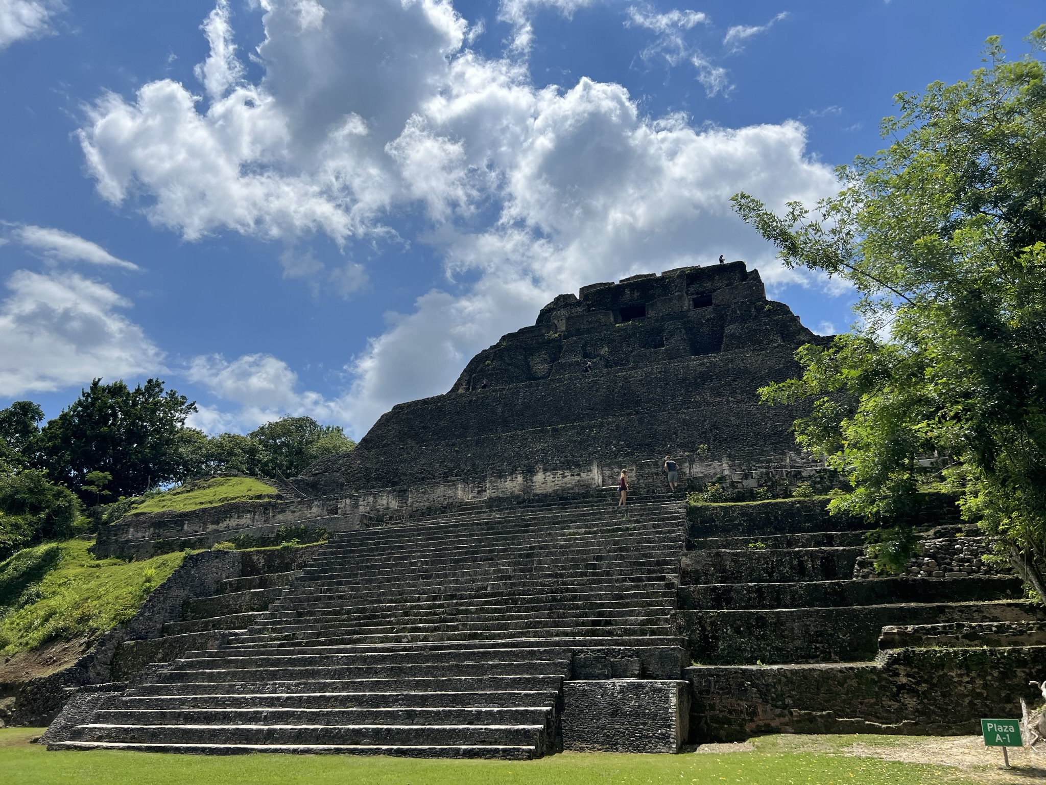
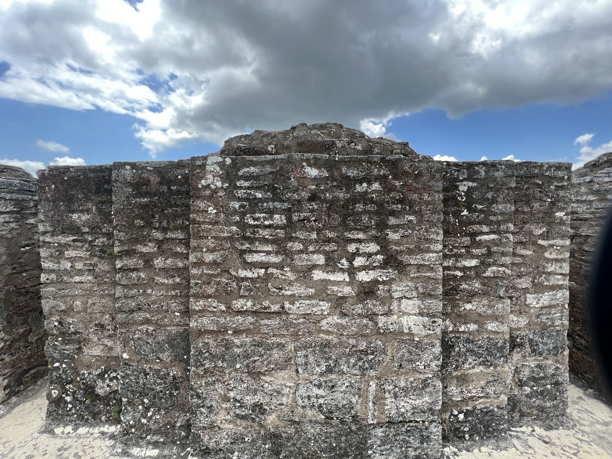
Perhaps the most striking of all the constructions here is El Castillo, a large pyramidal structure that stands around forty metres high. As we started our way up the north staircase, we could already see the elaborate frieze on the temple’s eastern side, which once wrapped around the entire building. This, Carlos told us, made reference to the sun, moon, and Venus. As we continued up an interior stairway, we found ourselves at the top of the pyramid, where we could admire two chambers standing parallel to each other. As always, the view from the top left us in pure ecstasy – the plaza right beneath our feet and the Group C structures surrounded by jungle stretching out before our eyes. From here, we could spot various platforms used for ceremonial and civic purposes, as well as other ballcourts, temples, and pyramids.
As we carefully made our way down, we headed toward Group C, stumbling upon Kay and Darcy, who had randomly decided to come here as part of a day tour. They had made the right choice by roaming the temples freely without a guide, though. Leaving Carlos to rest in one of the plazas, we continued the tour with the others, climbing pyramids and taking our time to absorb it all. It felt so good being in another Mayan ruin site after so long that I didn’t even mind the fact that I’d barely learnt anything about its history.
Our plans – or rather, my itinerary – took us to yet another archaeological site: that of Cahal Pech. This time round, still exasperated from Carlos’s “tour”, I easily gave in to just wandering around the ruins without a guide. Thankfully, a museum at the entrance provided a clear overview of the city’s history.
The city of Cahal Pech, much like Xunantunich, was built on a hill overlooking the Mopan River in order to control trade routes. While it was first settled in the Early Preclassic period, it developed into one of the primary centres in the Belize River Valley during the Late Preclassic, when it reached a peak population of around 10,000 to 15,000 inhabitants.
https://www.researchgate.net/
The city is oriented along a southwest–northeast axis and boasts eight plazas, each containing the usual features – temples, pyramids, ballcourts, residential areas, and stelae. Upon entering Plaza B from the north side, one is welcomed by three pyramids on the left and a large raised platform to the east, which serves as the civic and ceremonial centre. To reach this platform, a staircase leads to a square-shaped entrance that opens directly into Plaza A, where some of the most important structures can be found. These include Structure A1, a multi-tiered pyramid measuring about 24 metres in height, which can be climbed via a central staircase.
We spent a couple of hours roaming the site freely, exploring the temples and residential areas, climbing up the labyrinthine interior staircases with narrow passages, twists, and confusing layouts, that left me completely disoriented by the end. Just like a baby archeologist being set loose on ruins!
Wanting me to experience the real San Ignacio as much as possible, Roy made it a point to drive me past Spanish Lookout – a Mennonite town where a couple of thousand Anabaptists live.
Mennonites, much like the Amish, are known for their idyllic lives, spent following Christ’s teachings and valuing rural life and agriculture above all. Unlike the Amish, however, Mennonites are more open to the use of modern technology, with the community of Spanish Lookout being more modernised than most. Belize’s Mennonites arrived in 1958 after immigrating from Canada, settling as farmers around the surrounding Aguacate Lagoon – a herbaceous swamp in the midst of a prairie and rolling hills that is home to thousands of avocado trees, from which it got its name. Also, just to throw it out there, the word aguacate literally translates to ‘tree testicles’. The lake is also a popular attraction among birdwatchers – attracting storks, herons, and hundreds of other species.
After a drive around their town and a walk by the lake, we made our way to the city of San Ignacio. Accustomed to his fancy resort, Roy had to make do with the cheap motel I’d already booked for us. The handsome fool thought I was joking when I told him I only needed a bed to sleep in and a bathroom to shower and, well, relieve myself. Imagine if he had to sleep with a regular backpacker – hah!
